& Construction

Integrated BIM tools, including Revit, AutoCAD, and Civil 3D
& Manufacturing

Professional CAD/CAM tools built on Inventor and AutoCAD
The future of the water industry depends on data management. But deriving more value from data comes with its own challenges, from aging infrastructure and siloed workflows to talent shortages and cybersecurity threats.
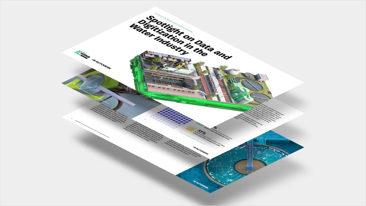
Discover the digital transformation strategies your industry peers are using to overcome these barriers in our latest report, Spotlight on Data and Digitization in the Water Industry: A State of Design & Make Special Edition.
Water shapes our lives and landscapes. However, extreme weather and rising demand pose challenges to both that must be answered. From storm and drought resilience to safe drinking water, whole ecosystems and communities rely on the effectiveness of infrastructure and the work of its designers, engineers, builders, and operators.
At Autodesk, we equip the water industry with the solutions needed to make the best decisions possible at every stage of a water asset’s lifecycle. Now cloud-connected and enhanced with AI, we can help you find efficiencies, enhance transparency, and deliver resilient outcomes even more consistently–ensuring the future of water is secure for all.
With aging infrastructure and increasingly frequent drought conditions, effective water distribution has never mattered more to communities—or bottom lines.
Our solutions help you to maximize water quality and efficiency while minimizing leaks with intelligent network design capabilities, accurate hydraulic modeling, and real-time analytics. As our partner, you can ensure the cost-effectiveness and longevity of your assets, while also conserving water, reducing energy usage, and improving customer satisfaction.
As many areas worldwide face more intense or prolonged periods of rainfall, 50-year flooding events begin to look a lot more like 5-year ones. Protecting people and communities in that context requires smarter hydraulic simulations and more predictive management that help mitigate floods and build resilience.
Our solutions combine these capabilities and more, helping you forecast how your system will respond to varying conditions and inform your decision-making around capacity fluctuations, system expansions, and emergency planning.
Urbanization and increased rainfall are placing pressure on wastewater systems that they were never designed to handle. Blockages, inflow, and infiltration events, as well as overflows cause network disruption, have negative environmental impact, and lead to financial pressures.
Our digital modeling and analytics can help alleviate these issues by giving you a real-time understanding of your network. With it, you can better evaluate risk, improve precision in catchment design, and simulate hydraulic dynamics for urban planning—so you can justify capital spend in areas like capacity improvement.
From design and build to operation and maintenance, how wastewater and water treatment plants are managed is critical to providing better water to local communities. Higher standards for resilience and water quality, as well as less energy and chemical usage, are driving a need for a deeper understanding of operations.
We can help you achieve that visibility through digital twin technology that streamlines operational and compliance challenges at scale, as well as lets you use sensor data to simulate, predict, and optimize performance. On top of that, our cloud-based collaboration solutions bring stakeholders together and lead to better-informed decisions that reduce risk, improve productivity, and enhance your level of service.
Technology is enabling a new era in water asset management. Real-time data, predictive analytics, and streamlined workflows mean operational decisions are far better informed and maintenance is handled proactively, not reactively–reducing operational costs and extending asset lifespans.
Our solution portfolio offers an ecosystem of software and cloud-based solutions that extract actionable insights from SCADA and IoT data. You can then visualize them and disperse them to relevant stakeholders quickly and efficiently, enhancing efficiency and compliance outcomes for your water infrastructure.
Davidson Water discovers PVC pipes can’t handle the pressure.
Fayetteville creates 100-year flood resiliency from scratch.
What happens when a steady-state sewer model goes dynamic?
Autodesk AI is empowering water professionals to build more resilient, sustainable infrastructure for communities worldwide, through capabilities like time-saving automations and machine learning-assisted simulations. See how we leverage AI-powered tools in our water portfolio with examples of successful outcomes.
Billions of gallons of water are wasted every year. But better use of data can find ways to conserve it more efficiently.
With increasing regulation, competition, and public scrutiny, capturing and understanding data is key to future success.
Our vision to deliver efficient, holistic water solutions that result in sustainable water systems for the planet.
Disparity in water supply and demand is growing, with potentially huge ramifications. Solving this water 'gap' is vital to the industry.
BIM and cloud are unlocking previously impossible levels of water asset optimization, including accomodating for climate extremes.
Unprecedented levels of flooding. Falling levels of water availability. How should utilities adapt to a more uncertain world?
Explore the latest news, trends, and technology in the world of water. Whether you're a water industry professional or simply want to be inspired, the One Water Blog is your go-to source for relevant and engaging stories.
Find the right modeling solution for you and get to know its features with our in-depth learning content.
Explore live and on-demand webinars related to water infrastructure topics and beyond.
Water professionals around the globe reshaping the way infrastructure is designed, operated, and maintained.
View our product roadmap for full transparency of our product vision and strategy for water software solutions.
Water professionals use detailed design software such as CAD, BIM, and GIS solutions; hydraulic modeling and process design software for analysis and simulation of water networks; asset management software for improved capital planning; and operational analytics software with artificial intelligence (AI) for informed decision-making.
Digital transformation is revolutionizing the water industry in three key ways.
Firstly, the adoption of digital twins allows the visualization of entire underground water systems, enabling real-time monitoring and early detection of issues. This technology amalgamates data from SCADA, IoT sensors, and historical records, offering a comprehensive overview of water infrastructure networks. Digital twins not only identify leaks promptly but also facilitate continuous improvement by highlighting weak areas.
Secondly, cloud collaboration is a central component of the digital journey. Water distribution networks are complex and require the input of numerous stakeholders. Cloud environments centralize data, fostering transparency and enabling real-time collaboration. This open ecosystem eliminates data silos, enhances visibility, and promotes interoperability, thereby streamlining water management processes.
Lastly, artificial intelligence (AI) is transforming water management by predicting failures, optimizing resource usage, and supporting sustainability efforts. AI-powered systems can monitor water levels, predict peak flows, inform predictive maintenance, optimize chemical treatments, and adjust operational parameters for energy efficiency.
Together, these digital advancements underscore the water industry's commitment to harnessing technology for sustainable and efficient water management practices.
Smart water management refers to the holistic integration of advanced technologies to transform traditional water infrastructure into intelligent, data-driven systems. At its core, this approach involves the deployment of sensors and the utilization of data analytics to monitor water quality, flow rates, and infrastructure performance in real-time. Pivotal to this is the creation of digital twins, virtual replicas of water systems that allow for comprehensive monitoring and analysis. Smart water management empowers utilities to remotely control operations, swiftly respond to issues, and optimize resource allocation, thereby enhancing overall operational efficiency.
Moreover, when facilitated by Autodesk, smart water management extends beyond real-time monitoring. It encompasses predictive maintenance solutions that leverage data analytics to anticipate equipment failures, minimizing downtime and improving the lifespan and performance of critical assets. The incorporation of smart metering and GIS technology further refines the process, allowing for precise measurement of water consumption and encouraging sustainable practices.
Innovyze was a global leader in building industry-leading software for water and wastewater professionals around the world before it was acquired by Autodesk in 2021. As part of this acquisition, Innovyze's solutions were integrated into our design and make platform to add even greater value and possibilities for our customers in the water industry.
Our aim is to serve the water industry through the full water asset lifecycle and equip planners, engineers, designers, builders, utilities, and others to make a better future. By incorporating the capabilities of Innovyze into our wider platform, we are building on a legacy of thirty years of development that have reliably delivered positive outcomes across the water cycle and seek to address the water challenges of the future.
Autodesk’s wide range of water solutions are used by water utilities, planners, engineers, project managers, and operators; federal and local municipalities; consulting firms and contractors; as well as site designers, developers, and landscape architects.
A hydraulic model is a mathematical model of a fluid flow system, such as a water, sewer, or storm system, used to analyze the system's behavior. A hydraulic model uses data, such as GIS, CAD, and as-builts to create a digital representation of the real-world system.
A hydrologic model is designed to estimate the amount of runoff or streamflow generated by rainfall. It represents the quantity of water generated from a specific land area or watershed. A hydrologic model aids in understanding, predicting, and managing water resources by capturing real-world data such as water flow and quality.
Cloud technology enables water and wastewater utilities to monitor, analyze, and optimize their operations and maintenance activities. Info360 is Autodesk’s cloud platform for the water industry. It provides the framework and shared services for applications that help water utilities of any size visualize and manage assets and operations today while predicting and preparing for future needs. As a result, utilities can deliver the highest possible service at the lowest possible cost.
Digital twins are virtual models of real-world systems that learn and adapt to changing circumstances. They are continuously updated by data and information. In the water industry, digital twins simulate the changing flows, levels, pressures, and controls in our water systems and tell us how well they are performing in the past, now, and in the future, reaching a level of sophistication where they can provide predictive recommendations to improved operational outcomes.
As a result, utilities are better able to manage flooding and overflows, reduce carbon, water leakage, energy, and chemical usage, optimize maintenance schedules, and rapidly respond to incidents.
Autodesk technical experts are happy to advise you on our range of solutions for the water industry and their potential benefits for your business.


