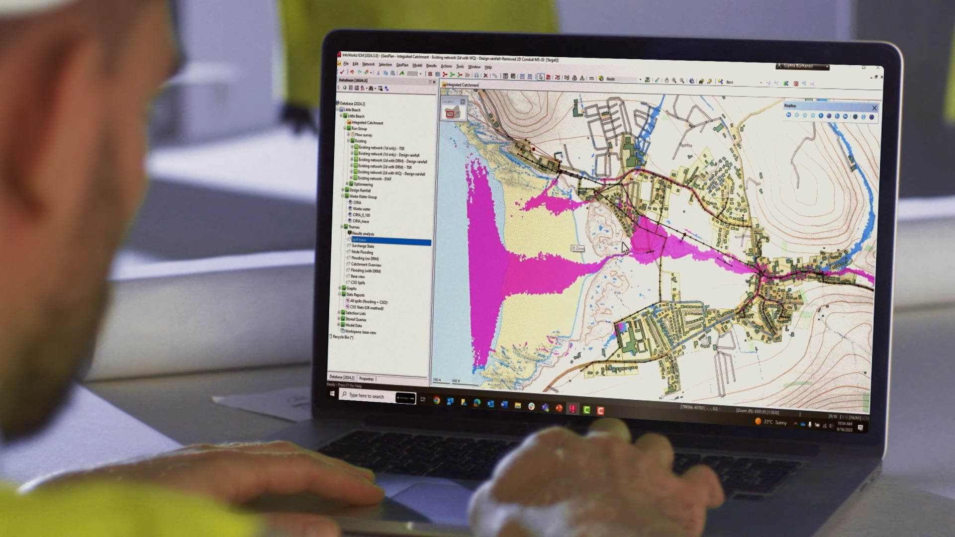
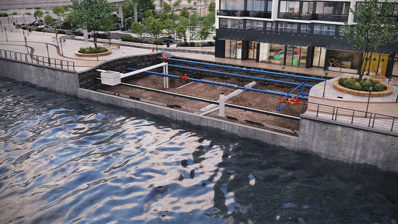
What is Autodesk InfoWorks ICM?
Autodesk InfoWorks ICM is a powerful, integrated catchment software for modeling and designing simple to complex hydraulic and hydrologic network elements quickly and accurately in a collaborative environment.
Plan for capacity improvements, system expansions, and emergency scenarios, with workflows that support defensible regulatory submissions.
Deliver fast, accurate, easy-to-interpret visual results to support stakeholder communication and digital twin decision making.
Model small to large stormwater and wastewater networks in the cloud or locally, scaling teams with capacity-based cloud compute when needed.
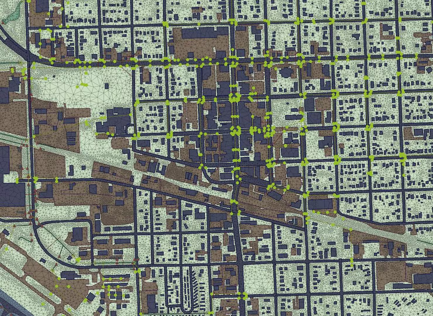
Improve the way you model with speed, accuracy, and connectivity
Accurate and powerful simulations
Plan and forecast for tomorrow, today
Scalable network design
Improve the way you model with speed, accuracy, and connectivity
Accurate and powerful simulations
Plan and forecast for tomorrow, today
Scalable network design
Why use Autodesk InfoWorks ICM?
Integrated catchment modeling
Gain access to a comprehensive and easy-to-use system for fully integrated catchment modeling, supporting consistent, auditable models for regulatory review.
Cloud computing
Run powerful simulations in the cloud or locally, delivering speed and efficiency improvements, with optional capacity-based cloud compute to scale as projects demand.
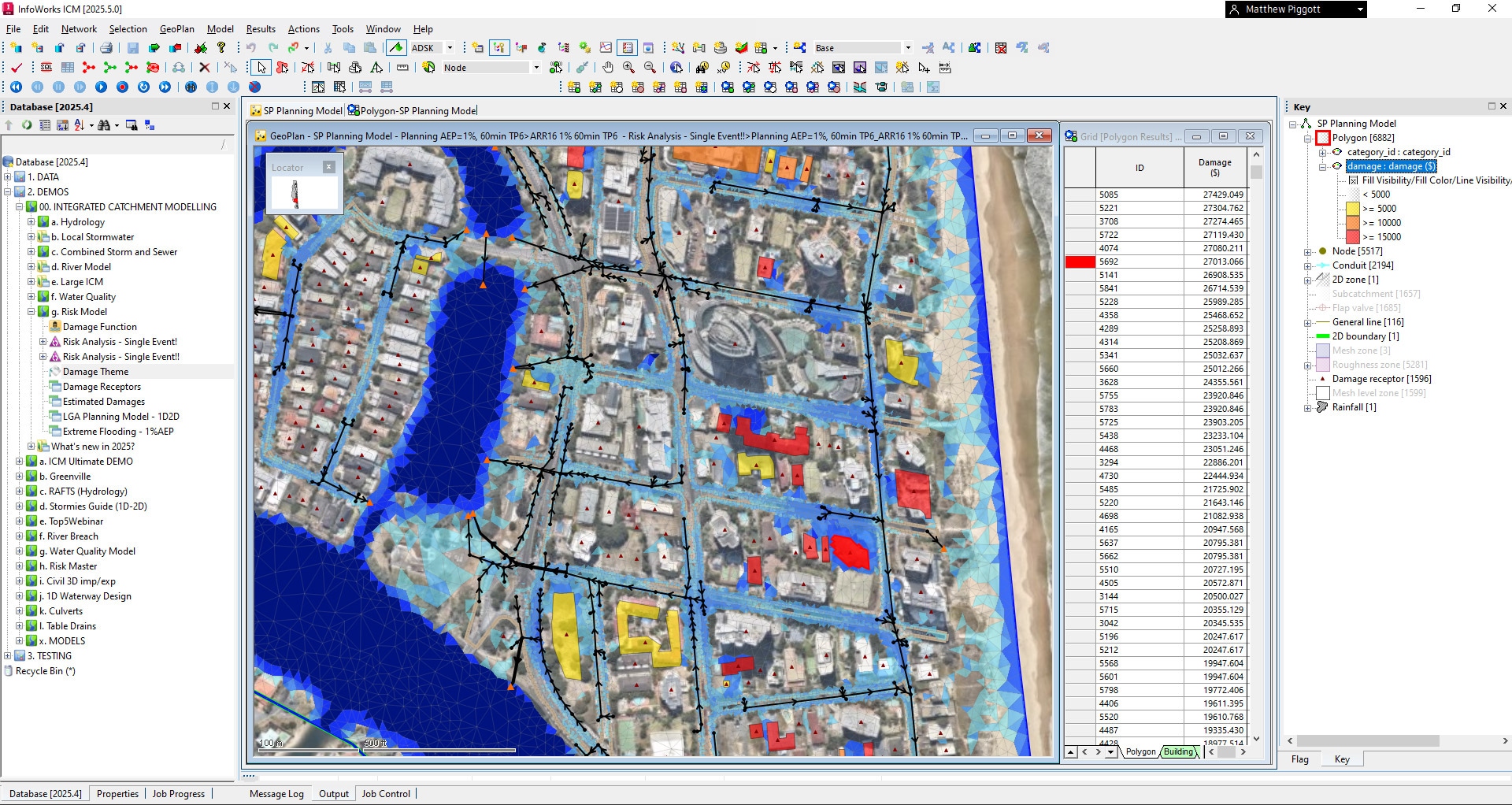
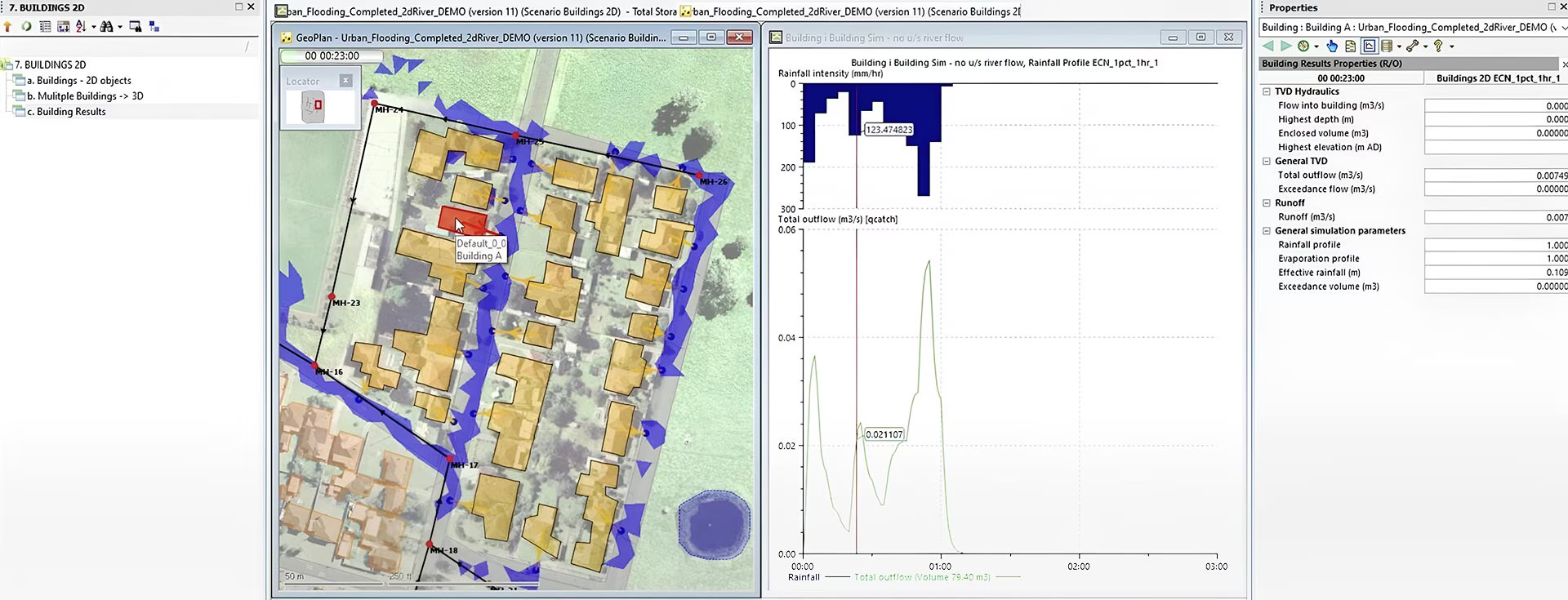
Integrated 1D and 2D modeling
Model complete drainage systems including sewers, surface water, rivers, and floodplains, supporting sewer and flood workflows across planning, design, and operations.
Collaborative simulation
Share model data among a workgroup of users with audit trails, permissions, and security mechanisms, supporting governance for digital maturity programs.
Scenario management
Create and edit multiple scenarios in parallel to compare outcomes, support regulatory justification, and accelerate decision making.
Data import
Quickly and easily import model data from other systems and automatically check for errors, reducing rework and supporting higher-confidence submissions.
Which InfoWorks ICM product is right for you?

InfoWorks ICM Sewer
InfoWorks ICM Sewer
InfoWorks ICM Sewer has appropriate tools for sewer-specific modeling, with unlimited 1D mesh nodes and limited (1K) nodes for 2D flood and 1D/2D integrated catchment modeling.
InfoWorks ICM Sewer has appropriate tools for sewer-specific modeling, with unlimited 1D mesh nodes and limited (1K) nodes for 2D flood and 1D/2D integrated catchment modeling.


"I felt like I had witnessed a mythological creature, something modelers only whisper about. Having this kind of capability is something that is often sought after in our industry but rarely found."
"By using InfoWorks ICM ... we were able to precisely measure all of our project goals and prove — without a doubt — that our watershed planning would deliver positive outcomes for the community."
"One of the most critical components of the entire system is the software thats been provided and created by Autodesk, its allowed us to create a Digital Twin of the entire system."
"It gave us better results. Now our model is able to keep up with the increase in groundwater."
"InfoWorks ICM has shown that we were justified in using the best modeling tools to get the best result."
Discover valuable resources
Case study
How ISG got their InfoWorks ICM models FEMA approved
ISG used the power of InfoWorks ICM to reevaluate historical flood risk maps and create new, more accurate flood models — and achieved regulatory buy-in from regional and federal authorities.
Technical hub
InfoWorks ICM Technical Information hub
The InfoWorks ICM Technical Information portal is your central hub — release notes, downloads, licensing, help docs, known issues, learning courses, scripting resources, and public product roadmaps, all in one place.
Free training
InfoWorks ICM free tutorial series
This free comprehensive course takes you from beginner to expert — covering system configuration through 2D mesh editing. Autodesk’s support and customer success teams make onboarding to InfoWorks ICM easy.

Roadmap
Autodesk water infrastructure product roadmap
See what product enhancements are on their way for InfoWorks ICM and understand how Autodesk supports planning, analysis, and management of storm, sewer, and flood networks.
Blog
Storm, Sewer, and Flood Blog
Explore how others are utilizing InfoWorks ICM, learn about the latest product releases, and stay up to date about the future of water infrastructure at Autodesk.


Questions? We have answers.
Both InfoWorks ICM and InfoWorks WS Pro include local simulation capabilities by default. Customers also have the option to run simulations in the cloud for greater scalability and performance.
Each subscription includes a set allocation of free cloud simulation hours. In certain cases — such as when running parallel or large-scale simulations — users may reach this allocation limit.
If you need additional capacity, you can purchase bundles of 500 cloud simulation hours directly through your Autodesk Account. This helps teams keep projects moving, scaling cloud simulations as modeling demands increase.
Autodesk InfoWorks ICM is an advanced integrated catchment modeling software. It allows small utilities and large enterprise organizations to model complex hydraulic and hydrologic network elements quickly, accurately, and collaboratively. Autodesk InfoWorks ICM helps you plan for capacity improvements, system expansions, and emergency scenarios for water and wastewater professionals.
Sewer and stormwater engineers, planners, project managers, and consultants use Autodesk InfoWorks ICM to face evolving challenges driven by regulations, level of service, customers, environment, and operations. By building accurate and holistic models, we’re able to predict how a system will respond to varying conditions. This allows you to better respond, plan, and fulfill the needs of your community. Plus, you can do it all using an industry-trusted, cross-team solution.
Products you can trust
From payment flexibility to always-on support, expect excellence.

