InfoWorks ICM
-
How Scottish Water transformed their hydraulic modelling – and stopped writing 100 reports per year
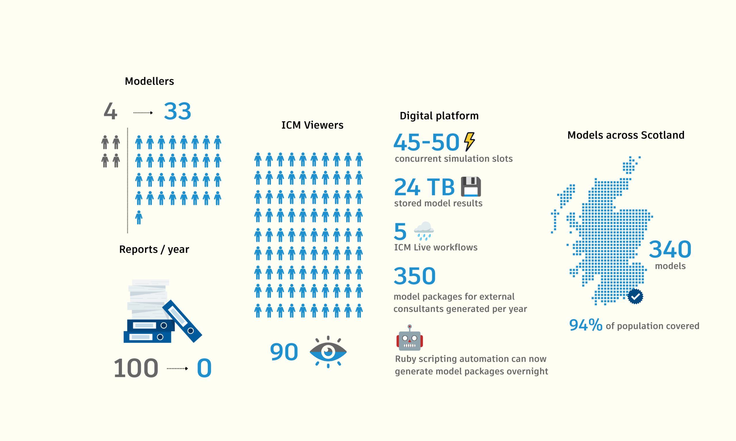
Digital transformation is often associated with adopting new technology, but for Scottish Water, it began with a much simpler question: How can we free engineers to spend more time engineering? Just over a decade ago, Scottish Water’s hydraulic modellers were producing more than 100 flooding reports every year. Today – remarkably – they produce none.…
Hydraulic modeling
-

How adaptive management and InfoWorks ICM helped KC Water save millions
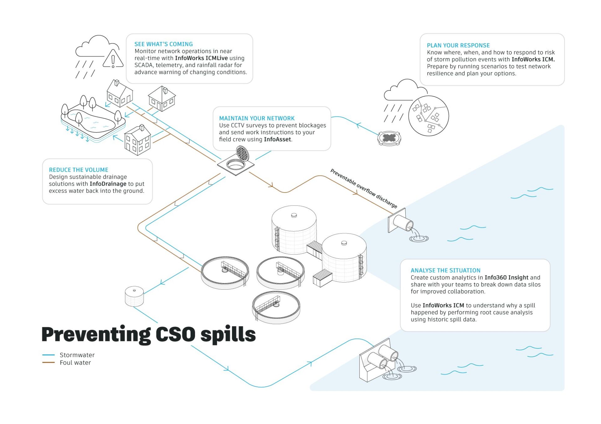
Kansas City, Missouri, like many older US cities, has a big sewer challenge hiding beneath its streets. They’ve taken on the challenge of defeating sewer overflows using the power of hydraulic modeling. KC Water serves a growing metropolitan area with thousands of miles of sewer pipe, 40 sewer pump stations, 27 satellite communities, and one…
Customer stories
-
InfoWorks ICM 2027.1: AI-powered assistance, richer Esri mapping, and smarter Network Design
InfoWorks ICM 2027.1 is now available, introducing new capabilities that help water professionals work more efficiently, visualize models with greater context, and streamline network design workflows. The latest InfoWorks ICM release brings Autodesk Assistant directly into InfoWorks ICM, making it easier to access guidance without leaving the modelling environment. We’ve also expanded GIS integration with…
Product news
-

When can you trust a flood model? Accuracy, calibration, and uncertainty explained.
Flood models are used to make important decisions: That’s why one of the most common questions in hydraulic modelling is: How accurate is the model? It’s a reasonable question. Engineers spend significant time calibrating models against observed water levels, flow rates, and flood extents. A model that cannot reproduce reality has limited value for planning,…
Hydraulic modeling
-

Why integrated hydraulic modeling is becoming essential for Middle East water infrastructure
Across the GCC and wider MENA region, utilities, municipalities, and engineering consultancies are accelerating investment in hydraulic modeling, stormwater management, flood resilience, and wastewater infrastructure modernization. From Dubai and Riyadh to Doha and Jeddah, large-scale urban expansion and climate-driven rainfall events are increasing pressure on drainage networks, sewer systems, and water infrastructure. Integrated approaches can…
Commentary
-

How our open-source GitHub repository grew from a simple idea into a global engineering community
Engineers working in hydraulic modeling are increasingly turning to GitHub, scripting, and AI tools to automate workflows and extend their models – including our customers. GitHub has become the world’s largest platform for sharing open-source code. Engineers, researchers, and developers use it to publish everything from small scripts to full software projects. Many widely used…
Hydraulic modeling
-
Integrated catchment modeling explained: How rivers, sewers and surface water interact
Integrated catchment modeling is the simulation of how water moves across an entire catchment by combining rivers, drainage networks, and surface flow within a single model. It allows engineers to understand how different parts of a water system interact during events such as flooding by performing complex hydraulic modeling. This approach combines 1D and 2D…
Hydraulic modeling
-
Hydraulic modeling explained: a guide to 1D, 2D and integrated catchment modeling
Hydraulic modelling is the simulation of how water flows through systems such as pipes, rivers, and surface floodplains. Engineers use it to predict water levels, flow rates, and flood risk, helping design and manage water infrastructure under different conditions. Hydraulic modeling often combines 1D and 2D approaches to represent both network flows and surface behavior…
Hydraulic modeling
-
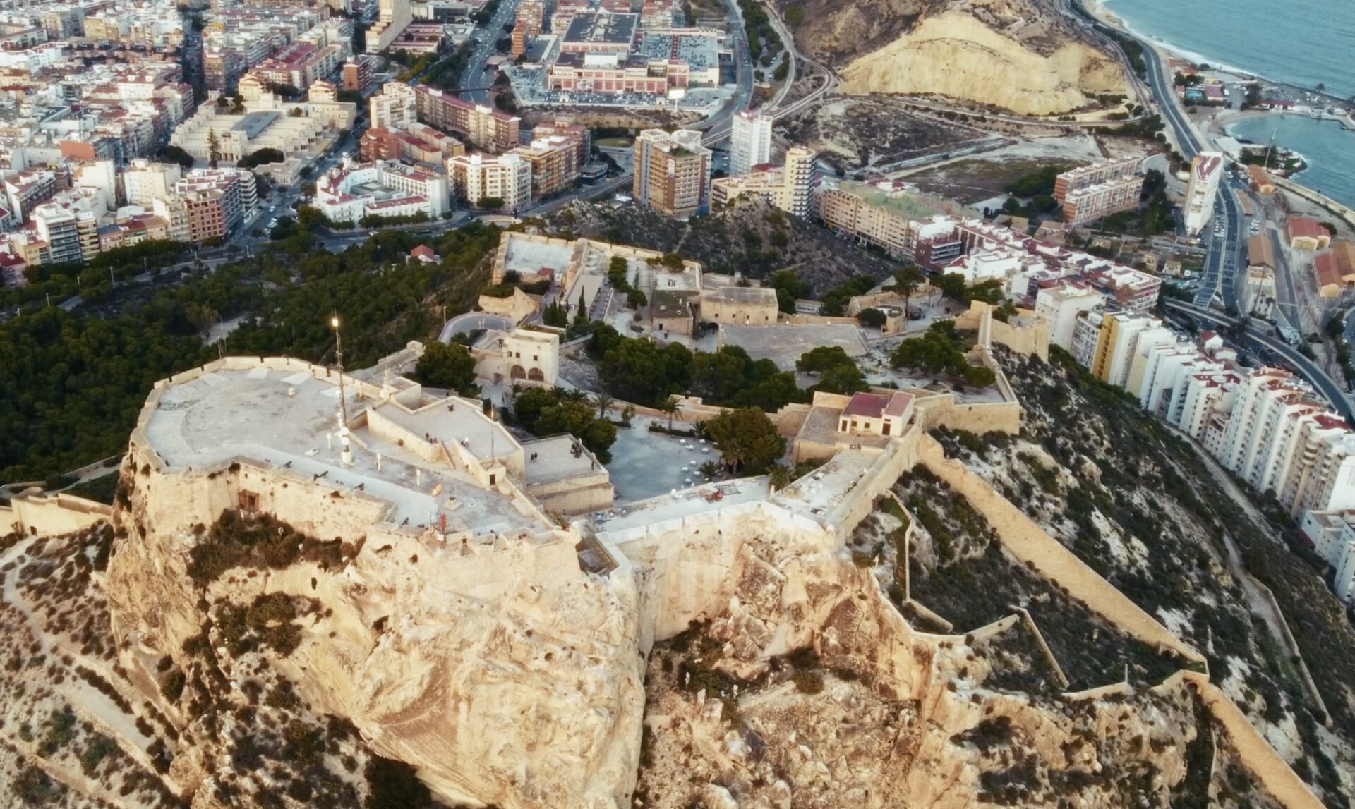
Aguas de Alicante’s digital twin water transformation
Aguas de Alicante is one of Spain’s oldest water utilities, with roots dating back to 1898 when potable water was first brought to the city of Alicante. It operates under a public-private model and manages the integrated water cycle — including water capture, treatment, distribution, sewerage, and wastewater purification — for Alicante and surrounding municipalities.…
Customer stories
-
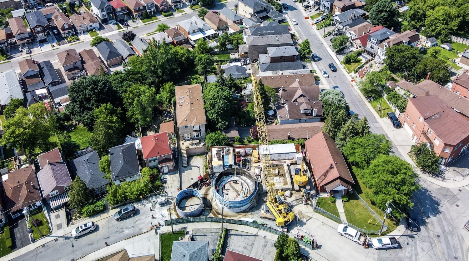
Jacobs: How 1D + 2D modeling in InfoWorks ICM is controlling stormwater in Toronto (and saving $$$)
The Woodborough Park neighborhood in Toronto is part of the Fairbank-Silverthorn area, which experiences significant flooding challenges, especially during heavy rainfall events. Their two big problems are a long history of basement flooding and sewer system overloads. Like many North American cities without separate sewer and water systems, they struggle with CSOs (Combined Sewer Overflows),…
Hydraulic modeling