-
JMT Improves Productivity and Collaboration with Model Coordination
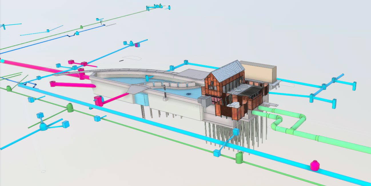
Model Coordination elevates civil design throughout the entire project lifecycle Through Model Coordination available with Autodesk BIM Collaborate Pro, Johnson, Mirmiran & Thompson (JMT) brings engineers working in the vertical and horizontal realms closer together on projects. Clashes are reduced, collaboration is…
Customer Success
-
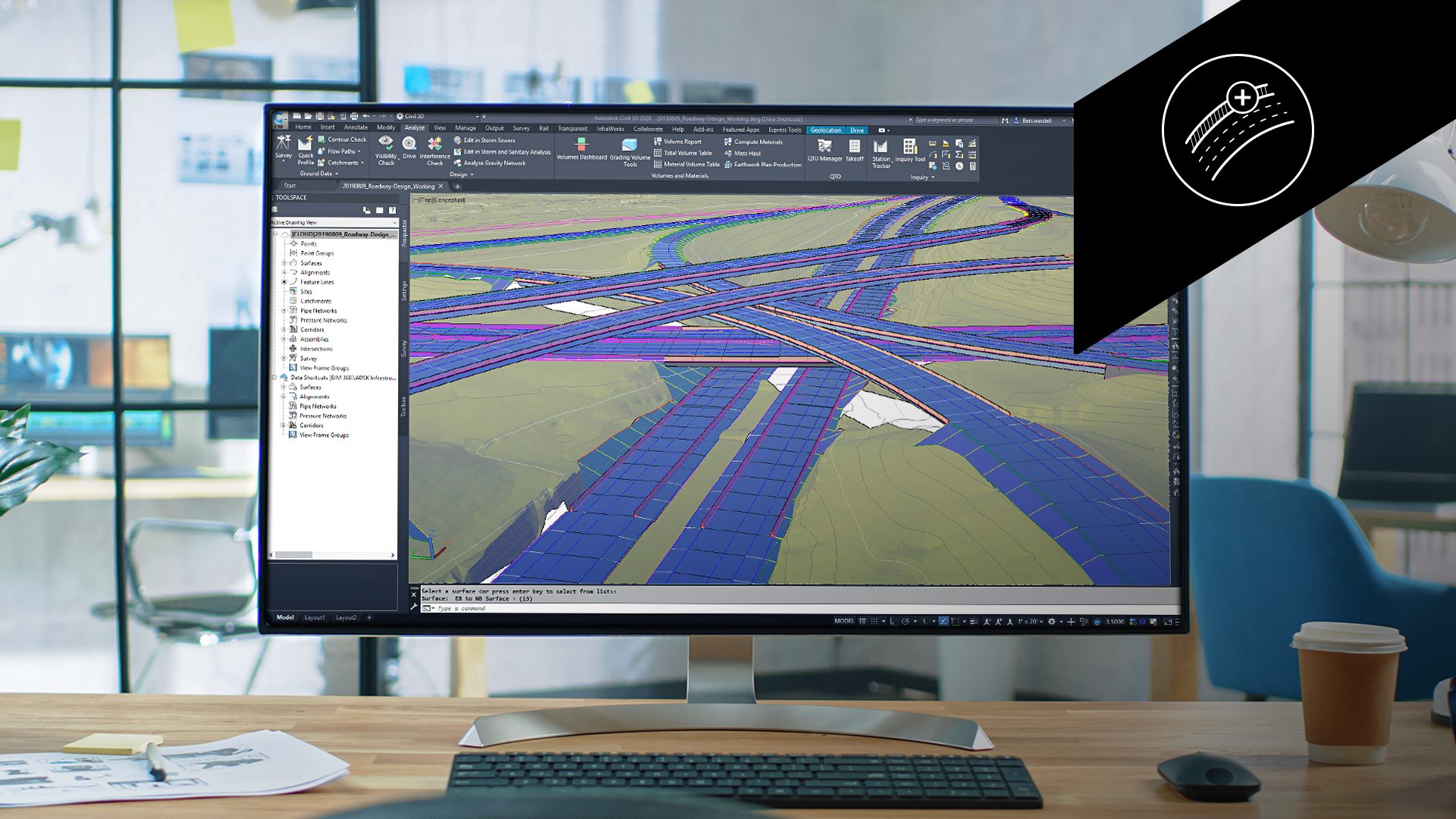
Roadway Design in Civil 3D – Learning Series Part 4: Assemblies and the Subassembly Composer
Assemblies and sub-assemblies are the building blocks of roadway design. As road demands become more complex, the ability to detail varied roadway sections is vital for effective transportation infrastructure design and engineering. Autodesk Civil 3D offers robust tools for designing and customizing…
Infrastructure
-
What’s New in Civil 3D 2025.1
Save time and enhance civil engineering design with user-driven improvements and key integrations From faster performance in corridors and surfaces to enhanced features for roadway and rail design, Civil 3D 2025.1 brings more improvements than ever to make your work more efficient.…
What’s New
-

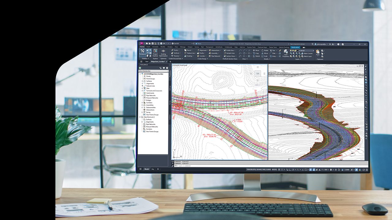
Roadway Design in Civil 3D – Learning Series Part 3: Roadway Profiles
With the growing demand for smart road infrastructure, roadway designers need precise and flexible tools. One critical aspect of road design is the roadway profile, which provides a detailed view of vertical changes in a road, helping designers manage gradients, optimize drainage,…
Learning
-

Configuring Multi-Team Collaboration on Civil 3D Cloud Projects
Today, we’ll take our first look at the team space concept within Autodesk Construction Cloud. Team spaces create an environment where multiple teams can have their own collaborative space inside a Civil 3D project. Using a team space, each team can work…
Learning
-

Sharing Civil 3D Cloud Project Files with Internal and External Stakeholders
Autodesk Construction Cloud provides several options for exchanging content with internal and external stakeholders. In our recent 30 min. Workout, we explored some formal and informal methods of file sharing. Using the informal methods shown, project managers can easily share content with…
Infrastructure