-
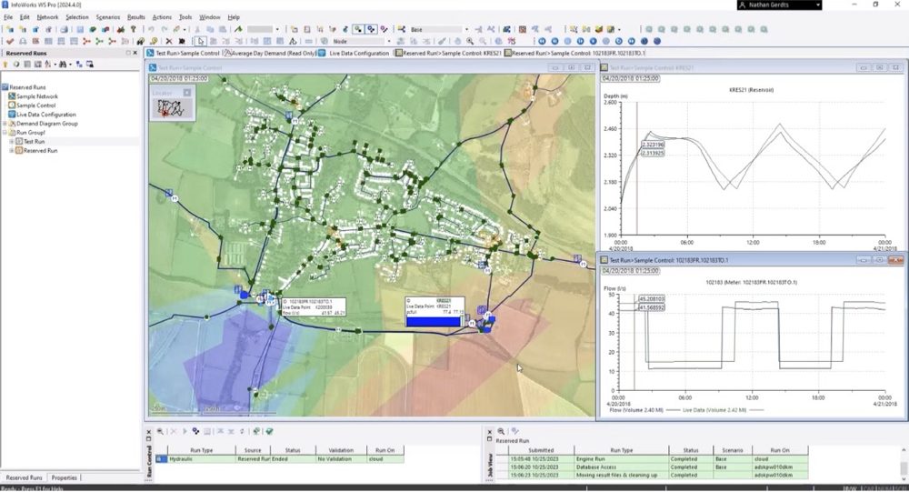
InfoWorks WS Pro 2024.4: Reserved runs in the cloud, live data configuration, and quality improvements
The latest version of InfoWorks WS Pro is here, bringing improvements to the platform in a variety of ways. Perhaps most significantly, you now have access to reserved runs in the cloud, streamlining collaboration and workflows. Additionally, the development and QA teams have built in streamlined live data configurations and made a variety of quality improvements…
Product news
-

Water Drops: A batch of lesser-known workflows that deserve the spotlight
This release of Water Drops workflow videos is exceptional – that is, we go over some of the lesser-known capabilities of our software packages that we want to make sure aren’t overlooked. For example, did you know you can also design sanitary networks in InfoDrainage? Or, have you ever wondered how other Innovyze products (specifically,…
Water Talks
-
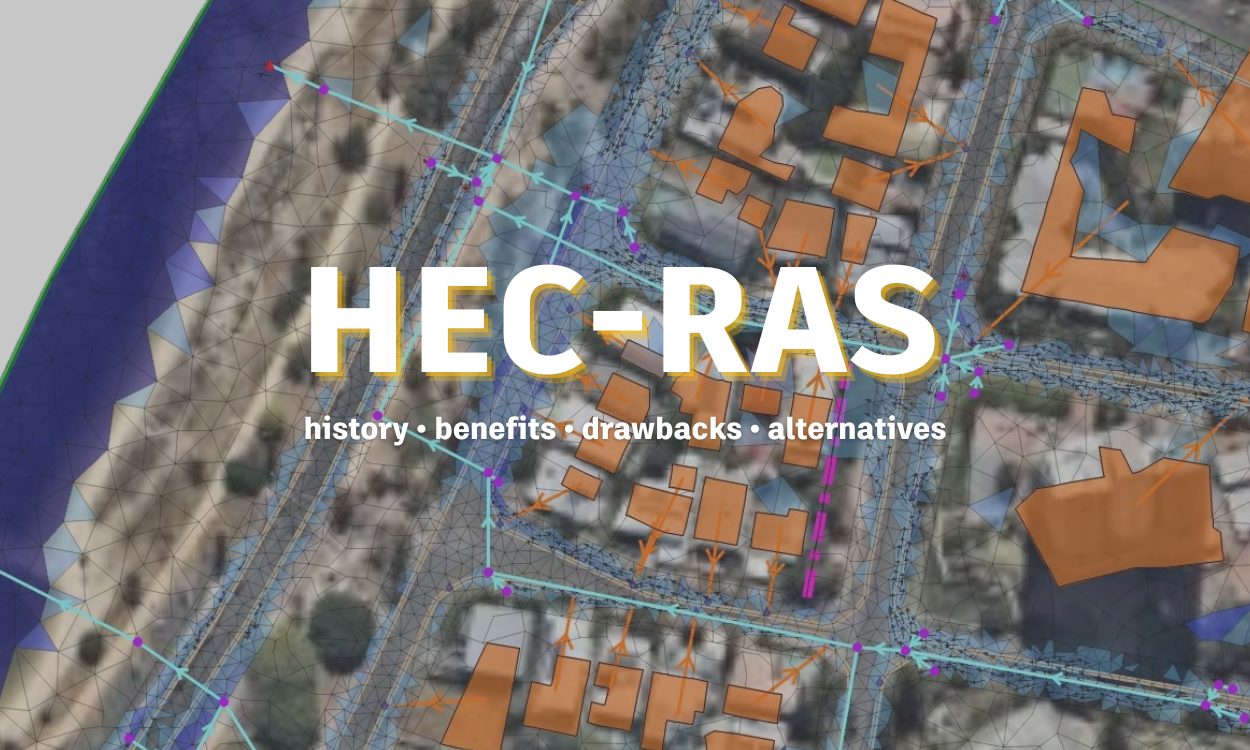
HEC-RAS: Its history, benefits, drawbacks, and alternatives
For much of human history, rivers were one of the most prevalent resources to civilization, serving as the liquid highways for goods and providing needed water for irrigation. It’s no wonder then why the world’s top minds have long toiled over how to control rivers and understand their flow. While understanding rivers presented persistent toil…
Storm, sewer, flood
-
Improved asset condition and inspection data management in Info360 Asset
Asset and condition inspection data are at the foundation of how water professionals build out risk and asset prioritization plans – prioritization plans that are essential to how water utilities allocate their capital expenditures. We listen to your feedback on how you manage condition assessment inspections and asset data, and our product and engineering development…
Product news
-

Our local superpower: Autodesk’s end-to-end consulting water partners
With the acquisition of Innovyze in 2021, Autodesk set out on an exciting journey to digitize the global water industry. But we are not doing this on our own. For over 30 years Autodesk has partnered with thoroughly vetted, professional Solution Providers (SPs), who are located all over the world and whose workforce consists…
Commentary
-
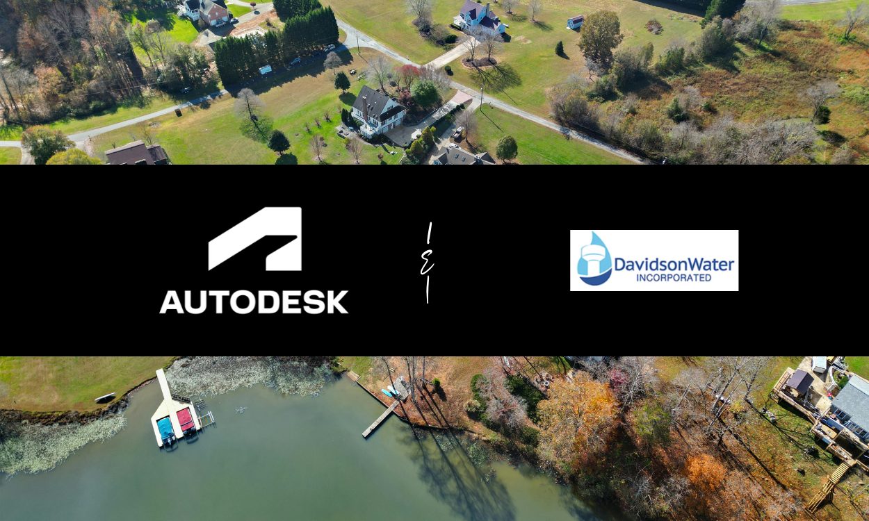
Davidson Water: masters of high-tech surge analysis and down-home community engagement
As a nonprofit membership-based organization, Davidson Water is entirely supported by the rates and fees paid by its member customers – no county taxes involved. Created over 50 years ago by enterprising businessmen who realized that this part of the popular Piedmont corridor of commerce and trade would not be able to host more business without…
Customer stories
-
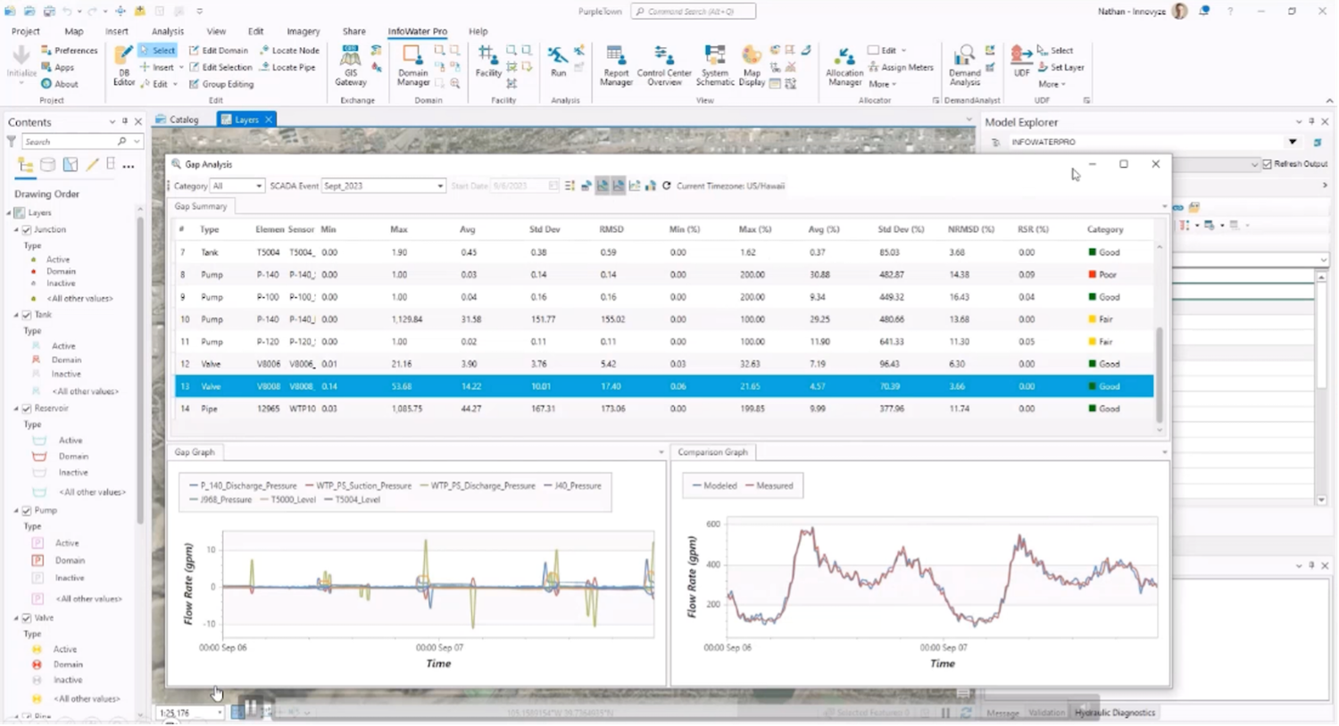
InfoWater Pro 2024.3: SCADA Event Runs from Info360 and Hydraulic Diagnostics improvements
Our development teams have been hard at work bringing new updates to InfoWater Pro this year. In the 2024.2 release, we rolled out fire flow simulations in the cloud, increasing speed and allowing modelers to save their local machines from intensive simulations. Notably, the Denver Water team said their fire flow“simulation times went from over 1.5 hours to…
Product news
-
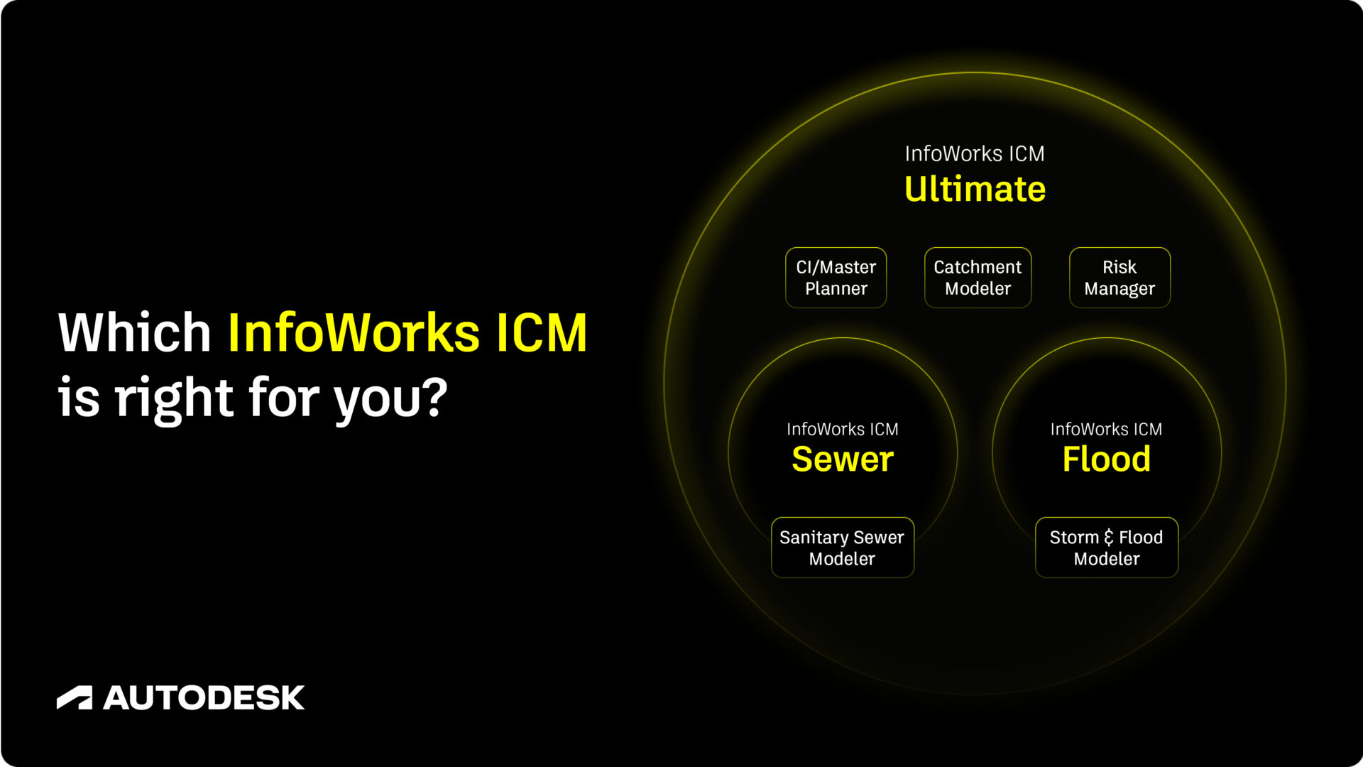
InfoWorks ICM Sewer vs. Flood vs. Ultimate: which one do you need?
Autodesk’s InfoWork ICM is catchment modeling software which can be applied to hydraulic modeling challenges as diverse as: Goodbye, ‘Standard vs Ultimate’ In the past, InfoWorks ICM was available in two flavors: Standard and Ultimate. However, in June of 2025, Autodesk announced two new options for customers who didn’t require access to every toolset available in InfoWorks…
Storm, sewer, flood
-

New Autodesk learning courses for InfoWater Pro, InfoWorks WS Pro, InfoDrainage and InfoWorks ICM
We’re happy to report that we’ve just released our latest course on the Customer Success Hub for InfoWorks ICM. It joins three other new Autodesk Water courses: The importance of basic training Autodesk water apps can help engineers do powerful things – and the deeper you go into the details, the more power you acquire…
Product news
-

Mitigating wet weather events with InfoWorks ICM: an overview of the software’s essential use cases
Understanding and mitigating storm, sewer, and flooding events is a complex challenge known well by those in the water industry. In this post we walk through how InfoWorks ICM empowers users through the capacity planning process, Combined Sewer Overflow (CSO) mitigation, and even walk through its integration with Autodesk Civil 3D. What are the essential…
Storm, sewer, flood