Note: This feature is not yet available to existing customers and will be released soon.
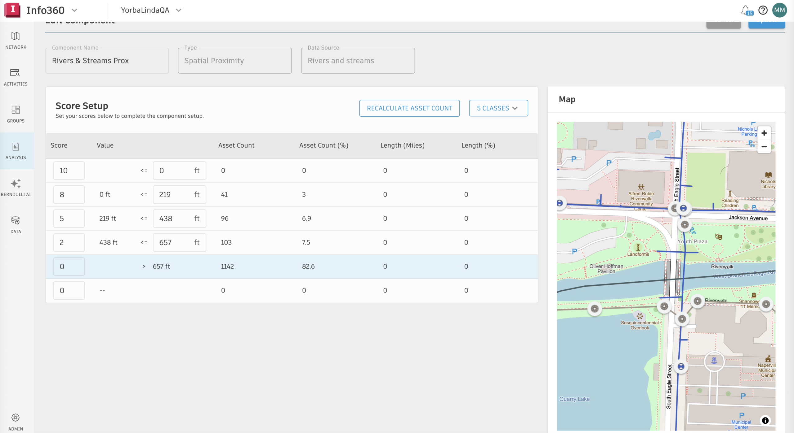
Autodesk is standardizing the Info360 platform on Esri as the GIS system of record across Info360 Asset and Info360 Insight. This aligns operational data, asset intelligence, and capital planning with the same authoritative GIS environment that utilities and water engineering consultants already use to manage infrastructure projects. It also reflects deeper alignment between Autodesk and Esri, strengthening how infrastructure data connects across planning, design, and operations.
Work from a single, consistent map environment
Water utilities rely on GIS as the authoritative system for understanding their infrastructure networks. Pipes, valves, pump stations, and facilities are mapped, maintained, and governed inside ArcGIS environments used across the organization.
Until now, Info360 has used a mapping system separate from the GIS system of record. This created unnecessary complexity, requiring utilities to reconcile data across systems, maintain multiple map environments, and manage inconsistencies in how infrastructure is visualized.
With this release, Info360 Asset and Info360 Insight now run directly on the Esri ArcGIS Location Platform. Using Esri basemaps and services as the core mapping engine, utilities can view asset condition, risk models, inspections, sensors, incidents, and capital infrastructure plans in the same GIS platform they use every day. This reduces time spent reconciling data and provides a more consistent view of the network to support both day-to-day operations and long-term planning.
How it works
Info360 now uses Esri as its primary mapping engine, integrating with ArcGIS through the Esri Maps SDK and ArcGIS Location Platform. This brings authoritative, enterprise-grade location intelligence directly into Info360, with faster performance, richer visualization, and seamless interoperability with ArcGIS services and content.
Key capabilities include:
- Native support for Esri basemaps and imagery
- Visualization of utilities, water, wastewater, and stormwater networks
- Vector tile layer support for inspections, sensors, facilities, and incidents
- GIS-aligned visualization of risk and rehabilitation models
- Dynamic map services supporting query, search, and analysis
- Improved map navigation, filtering, and asset search
Together, this enables teams to explore assets more intuitively, prioritize investment with greater confidence, and act faster using a consistent, GIS-aligned view of their network.
Built for what’s next
This integration with Esri ArcGIS establishes a future-ready foundation for Info360, enabling more location-based capabilities over time. As the platform evolves, utilities can take advantage of richer feature services, deeper geospatial context, and more advanced GIS-driven workflows—without needing to rework their mapping environment.
Ready to get started?
Existing Info360 Asset and Info360 Insight customers will see an updated map environment in the product in the coming weeks.
New to Info360? Visit the Info360 Asset and Info360 Insight product pages to learn more, contact our team, or start a free trial.