 Heather Miller
Previously known as the Site C Clean Energy Project, the new John Horgan Dam and Generating Station demonstrates how BIM, cloud collaboration, and digital project delivery helped bring one of Canada’s largest and most complex infrastructure projects from design to operation.
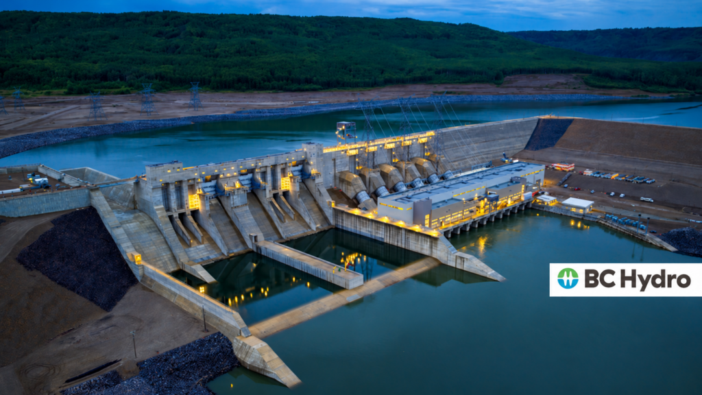
Stretching more than a kilometer across the Peace River in northeastern British Columbia, BC Hydro’s John Horgan Dam and Generating Station (formerly known as the Site C Clean Energy Project) is immense by nearly every measure.
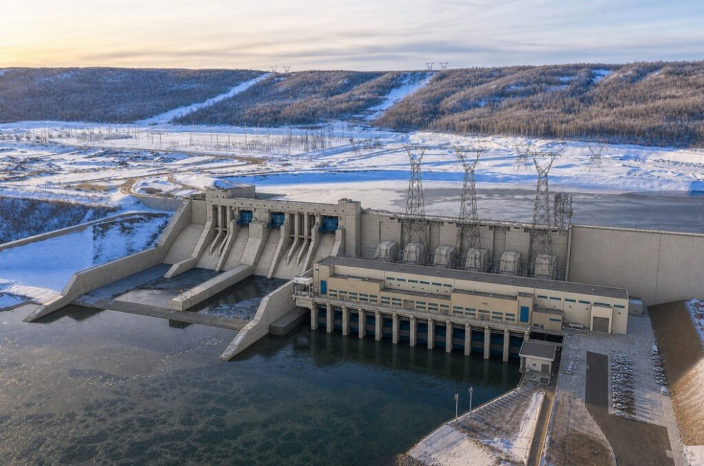
The $16 billion project is the third dam and hydroelectric generating station on the Peace River. Its major components include an approximately 1,050-meter-long, 60-meter-high earthfill dam; a generating station with six 205-megawatt units; nine spillway gates; two new 500-kilovolt transmission lines; highway realignments; and an 800-metre roller-compacted-concrete (RCC) buttress for enhanced seismic protection.
Design and feedback began in the mid-2000s before a single shovel first hit the dirt in 2015. The first generating unit entered service in October 2024, and the sixth and final unit was commissioned in August 2025. With all six units operating, the hydroelectric facility provides more than 1,230 megawatts of capacity and produces approximately 5,100 gigawatt-hours of electricity each year, which is enough to reliably power the equivalent of about 450,000 homes.
But the project is more than just the scale. Over its timeline, technology evolved dramatically, enabling the team to transform an established 2D design process into a coordinated BIM environment that supported hundreds of models, thousands of drawings, dozens of organizations, and contributors working across Canada and beyond. And Rodrigo Freig, founder of Modelo Tech Studio, was right at the center of it.
Switching to Revit and an entirely new BIM process
Freig first joined the project during a pivotal period 12 years ago and helped the BC Hydro team transition from AutoCAD and 2D to Autodesk Revit for a full BIM environment and workflow.
“We had to set up all of the infrastructure for the templates and model,” Freig says. “We needed to train people and figure out how we were going to structure this massive project. I’ve never worked on something so big.”
“There’s no cookie cutter treatment to it,” he adds. “You have to think outside the box in projects like this.”
One of the earliest benefits emerged when BC Hydro decided to convert previously completed 2D design information into 3D.
“In that process, we captured with Revit the coordination issues that the drawings had,” Freig says.
Using Revit exposed discrepancies between plans, sections, and elevations that could be difficult to recognize when each drawing was reviewed independently. In a BIM environment, the views were no longer separate interpretations of a structure.
“In 3D you can just catch everything because it’s parametric,” Freig says.
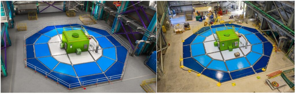
Across the total project, approximately 165 discipline working models were supported by more than 70 host models used for drawing production. Input from more than 40 companies was brought into the coordinated environment, including models developed in Revit, Autodesk Inventor, Autodesk Advance Steel, Autodesk Civil 3D, and AutoCAD.
The team used Revit across the project’s structures and equipment. During the design, more than 8,000 individual concrete lifts were modeled, giving engineers greater control over how massive concrete elements would be placed. The project’s walls were not typical building-scale assemblies; some were approximately 1.5 to 2 meters thick. Lift planning was critical to controlling pours, heat, concrete quality, and construction sequencing.
Coordinated models were also made available during procurement, allowing bidders to better understand the scope, visualize constraints, and develop pricing from a more complete representation of the work.
From resistance to reliance
Early in the transition, some engineers were hesitant to depend on 3D models. Familiar 2D processes supported infrastructure delivery for decades, and a model-based approach introduced new responsibilities, standards, and ways of reviewing design.
“At the beginning there was hesitation from engineers that were not used to working in 3D and they were resisting it,” Freig says.
The shift in attitude came quickly once teams experienced the value of visualization.
“Within the next year and a half that we started this, if I didn’t export the weekly version of the model, I’d end up with lots of emails asking, ‘Where’s the model? We need the model,’” Freig says.
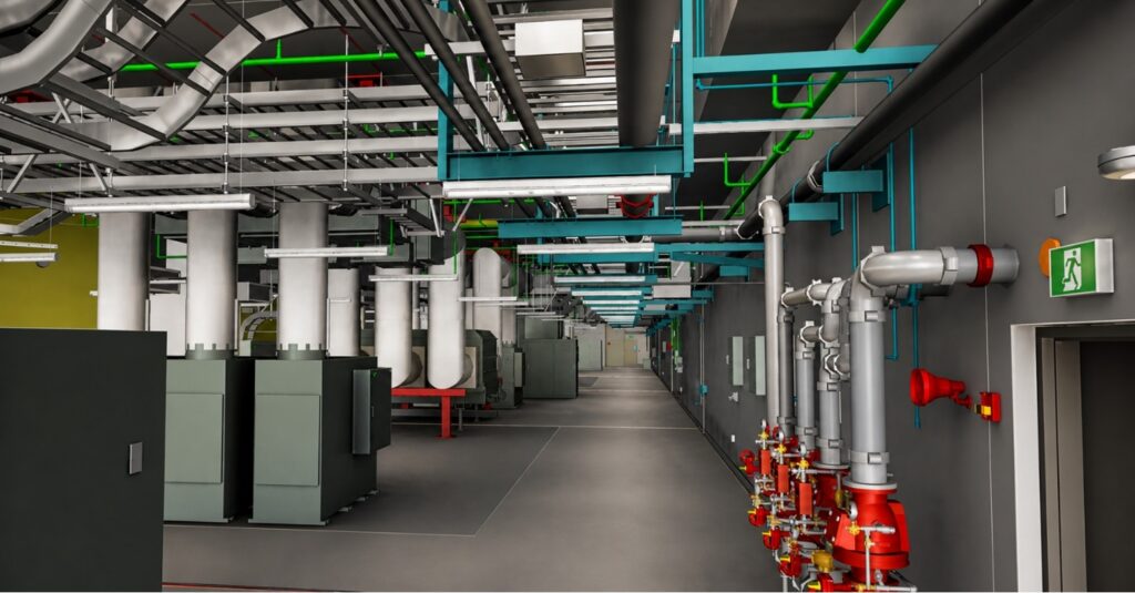
Weekly exports of the active models were combined and reviewed in Autodesk Navisworks. Coordination sessions involving large groups went beyond identifying clashes. Teams could evaluate access, maintenance clearances, construction sequencing, safety, operability, and how multiple systems would interact in the real world.
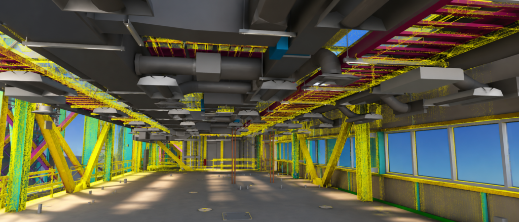
LiDAR scans later added another layer of confidence by allowing the modeled environment to be compared against as-built site conditions. The digital representation could evolve alongside physical construction, supporting validation, quality assurance, and more reliable record information.
“With BIM and Revit, we could complete one portion of the project in less than half the time it would normally take.”
– Rodrigo Freig, Co-Founder, Modelo Tech Studio
Moving collaboration to the cloud
When the team first started using Revit, they relied on closed networks and SharePoint-based exchanges. With so many large models, collaboration often meant manually uploading, downloading, saving, and reopening files. The process was time-consuming and made it more difficult to ensure that teams in different locations were working with current information.
In 2018, shortly after Forma Design Collaboration (formerly BIM Collaborate Pro) first became available, the John Horgan Dam and Generating Station became one of the largest infrastructure projects onboarded to the platform. This also included a move to Autodesk Forma (formerly Autodesk Construction Cloud) for a centralized cloud environment where distributed teams could share models, coordinate and collaborate, and access project information more efficiently.
“When we pushed for the project to go on Autodesk Forma and use Forma Design Collaboration, it was a lifesaver,” Freig says. “It saved a lot of time from having to upload, download, save, reopen files and all the other repetitive tasks that were a nuisance.”
The full value of that decision became clear during the COVID-19 pandemic. Because cloud collaboration was already established, designers, engineers, construction contractors, and vendors could continue working from home and offices across multiple regions without losing access to the shared modeling environment.
“When COVID started, we had a massive number of people working on the project,” Freig says. “We didn’t have a problem on the modeling or drafting side,” he says.
Maintaining stability across such a long-running digital ecosystem required strict governance. Software versions and updates were synchronized among participating teams, helping limit compatibility issues and file corruption. The approximately 165 active models passed through four major Revit platform upgrades during more than 12 years of work.
Now as the project nears completion for the remaining assets, project files are being transferred and handed over to BC Hydro’s current Autodesk Forma environment.
Value of using BIM
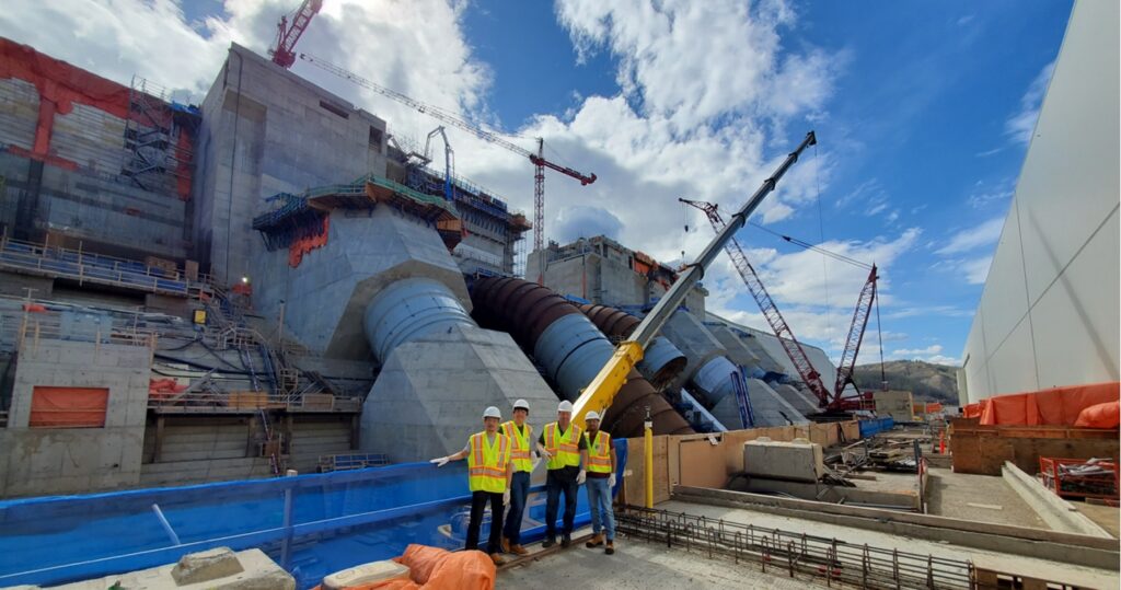
BIM ultimately became more than a coordination or drawing-production environment. It supported quantity takeoffs, design validation, 4D planning, installation tracking, payment validation, as-built verification, and structured asset information.
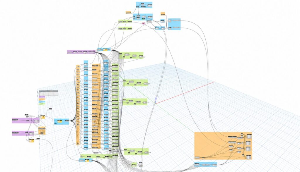
Dynamo scripts were used to synchronize equipment and engineering data between a master equipment list and the models. This reduced repetitive data entry and helped BC Hydro receive an as-built digital representation containing asset information developed throughout design.
“BIM saves you time during design,” says Jesus Sanchez, President, Modelo Tech Studio. “It helps avoid cost issues during construction. It gives you tons of information, accurate information, for facility maintenance, which allows operators in the long run to save time.”
“The main thing is that we are helping people and construction projects save time and cost through BIM because we help them catch things before they start digging in the ground,” Freig says.