InfoWorks ICM
-

How our open-source GitHub repository grew from a simple idea into a global engineering community
Engineers working in hydraulic modeling are increasingly turning to GitHub, scripting, and AI tools to automate workflows and extend their models – including our customers. GitHub has become the world’s largest platform for sharing open-source code. Engineers, researchers, and developers use it to publish everything from small scripts to full software projects. Many widely used…
Hydraulic modeling
-
Integrated catchment modeling explained: How rivers, sewers and surface water interact
Integrated catchment modeling is the simulation of how water moves across an entire catchment by combining rivers, drainage networks, and surface flow within a single model. It allows engineers to understand how different parts of a water system interact during events such as flooding by performing complex hydraulic modeling. This approach combines 1D and 2D…
Hydraulic modeling
-
Hydraulic modeling explained: a guide to 1D, 2D and integrated catchment modeling
Hydraulic modelling is the simulation of how water flows through systems such as pipes, rivers, and surface floodplains. Engineers use it to predict water levels, flow rates, and flood risk, helping design and manage water infrastructure under different conditions. Hydraulic modeling often combines 1D and 2D approaches to represent both network flows and surface behavior…
Hydraulic modeling
-

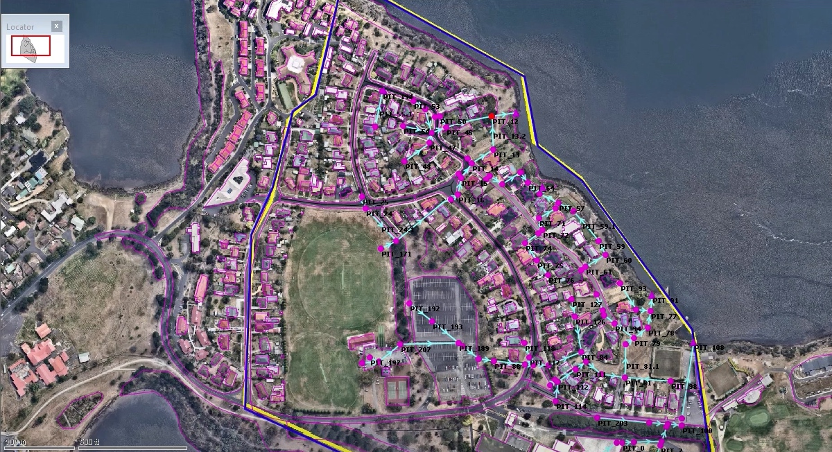
Aguas de Alicante’s digital twin water transformation
Aguas de Alicante is one of Spain’s oldest water utilities, with roots dating back to 1898 when potable water was first brought to the city of Alicante. It operates under a public-private model and manages the integrated water cycle — including water capture, treatment, distribution, sewerage, and wastewater purification — for Alicante and surrounding municipalities.…
Customer stories
-
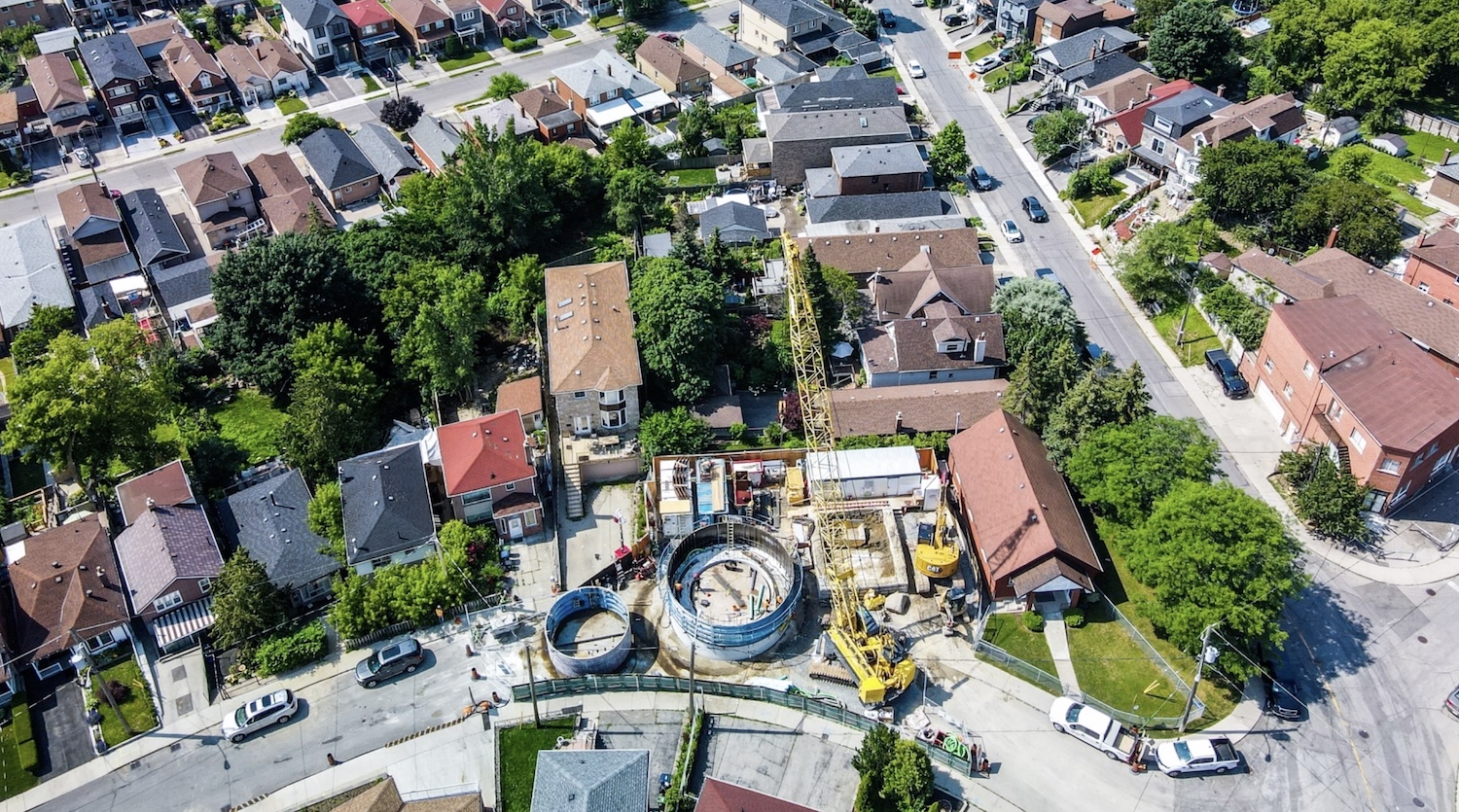
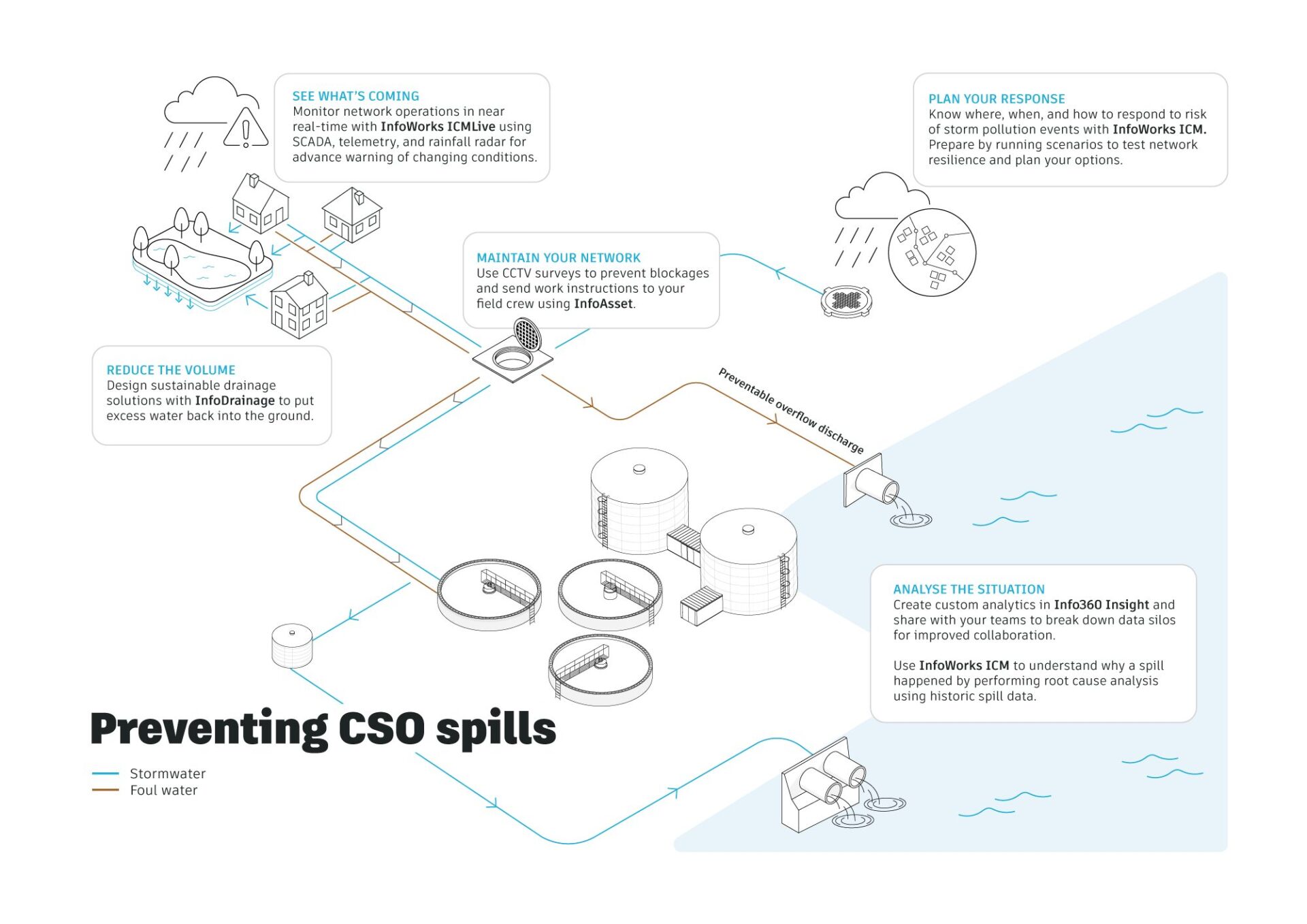
Jacobs: How 1D + 2D modeling in InfoWorks ICM is controlling stormwater in Toronto (and saving $$$)
The Woodborough Park neighborhood in Toronto is part of the Fairbank-Silverthorn area, which experiences significant flooding challenges, especially during heavy rainfall events. Their two big problems are a long history of basement flooding and sewer system overloads. Like many North American cities without separate sewer and water systems, they struggle with CSOs (Combined Sewer Overflows),…
Hydraulic modeling
-

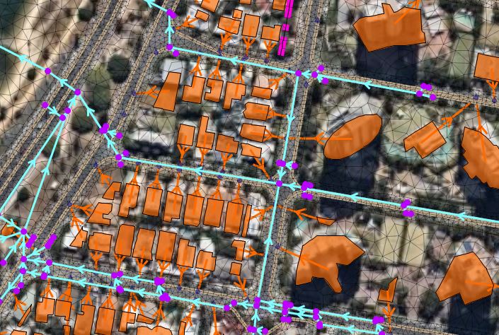
Houston’s Stormwater Master Plan: a modern approach to citywide modeling
Houston’s relationship with water has always been complex. Sometimes called the “Bayou City”, Houston has been flooding since it was founded in 1836. Flat terrain, lots of concrete, expansive development, its position near the coast, and increasingly intense rainfall events have made stormwater management one of the city’s most critical infrastructure challenges. But they’ve been…
Storm, sewer, flood
-
InfoWorks ICM 2026.3: Raster workflows, expanded subgrid meshing, 2D boundaries, and a more polished interface
As urban drainage and flood modeling challenges continue to grow in complexity, modelers need tools that can scale with larger datasets, richer terrain detail, and increasingly global data sources, without adding friction to everyday workflows. In InfoWorks ICM 2026.3, we’ve focused on strengthening some of the most heavily used parts of the platform: raster-based workflows,…
Product news
-

Implementing the updated Australian Rainfall and Runoff guidelines to account for climate change
With heavy short-term rainfall events becoming more intense, it’s critical that Australia’s flood maps are dynamically altered to include the most up-to-date ARR guidelines. Because our software offers customizable rainfall calculations, you can adjust equations to go beyond standard calculations – to account for climate change or to apply specific details that affect your location. Australia is…
Storm, sewer, flood
-
Using Ruby scripting with AI agents to extend and improve your hydraulic models
The art of hydraulic modeling straddles the intersection of creative ingenuity and technical prowess. Can AI agents help you be more creative and technically proficient even if you don’t have a background in computer programming? Creating an effective and accurate hydraulic model isn’t just about ingesting all of your data, but also about getting all…
AI and Machine Learning
-

Autodesk and Esri partnership expands with new InfoWorks ICM and InfoWorks WS Pro integrations
These new Esri integration capabilities in our latest software updates will make it easier for you to tap into the existing Esri data and tools that you’ve invested in and bridge the gap between GIS and BIM, enhancing your overall productivity and data accuracy. Since establishing a strategic partnership, Autodesk and Esri have been committed…
Product news