InfoDrainage
-
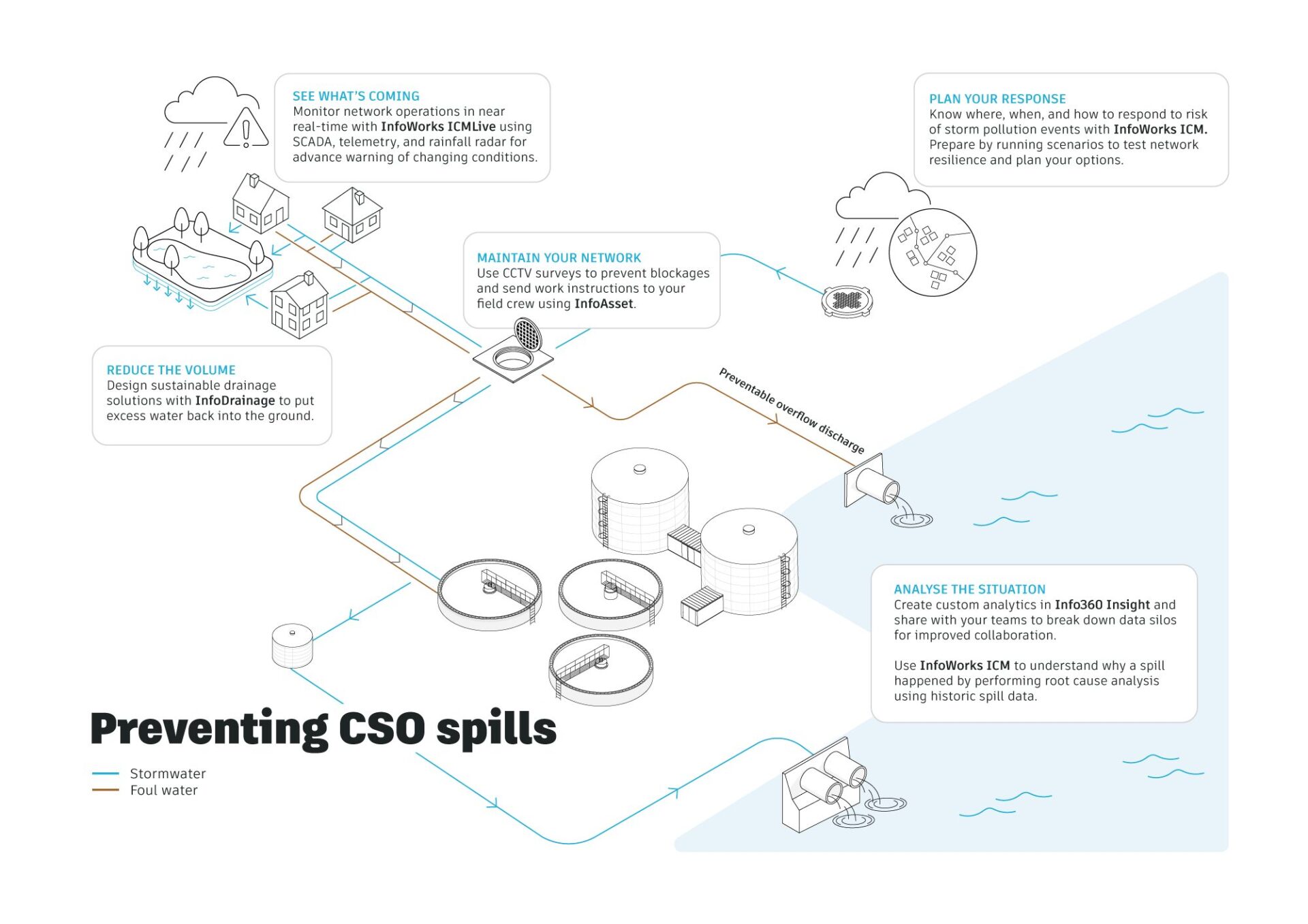
Hydraulic modeling explained: a guide to 1D, 2D and integrated catchment modeling
Hydraulic modelling is the simulation of how water flows through systems such as pipes, rivers, and surface floodplains. Engineers use it to predict water levels, flow rates, and flood risk, helping design and manage water infrastructure under different conditions. Hydraulic modeling often combines 1D and 2D approaches to represent both network flows and surface behavior…
Hydraulic modeling
-
InfoDrainage vs Civil 3D drainage tools: What’s different – and when to use each one
Civil 3D 2026 drainage tools are best for analyzing the drainage system in your drawing (pipes, catchments, ponds), while InfoDrainage is best for design automation, iteration, and flexible reporting.
Drainage design
-
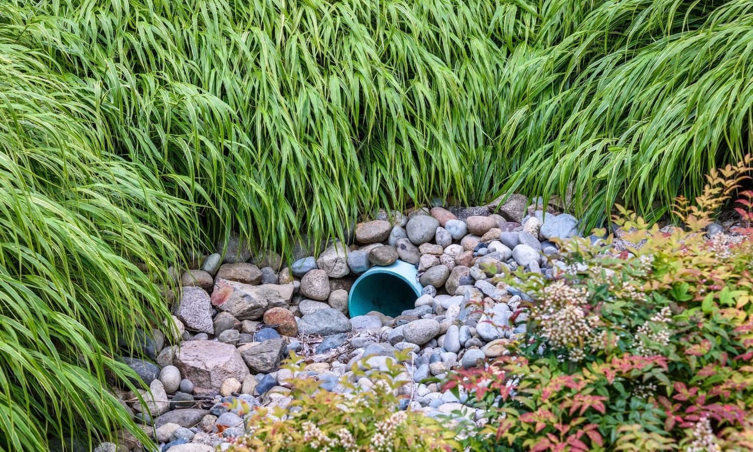
What are sustainable drainage systems (SuDS)? Features, types and design principles
In many urban areas, rainfall doesn’t soak into the ground. It runs off hard surfaces, overwhelms drainage systems, and contributes to flooding and pollution. SuDS (Sustainable Drainage Systems) are designed to change that. SuDS are designed to manage rainfall in a way that mimics natural processes – slowing, storing, and treating water close to where it…
Drainage design
-
Drainage designed for nature – and people: GBM’s commitment to SuDS at Fuenlabrada Fairground Park
Urban drainage is undergoing a fundamental transformation around the world. As cities expand and climate patterns become more extreme, traditional drainage strategies, which are focused almost exclusively on collecting and evacuating stormwater, are proving increasingly inadequate. Capacity constraints, water quality impacts, energy consumption, and flood risk are forcing engineers and planners to rethink how urban…
Drainage design
-

Is the InfoDrainage ML Deluge tool ‘the future in drainage AI?’
Autodesk AI inside InfoDrainage represents a leap forward in drainage design technology, bringing Machine Learning capabilities directly into the workflows that engineers use daily. This artificial intelligence integration, powered by the InfoDrainage Machine Learning Deluge tool, may transform how professionals approach overland flow analysis and stormwater control placement. That is the set-up for Civil Tech…
Drainage design
-
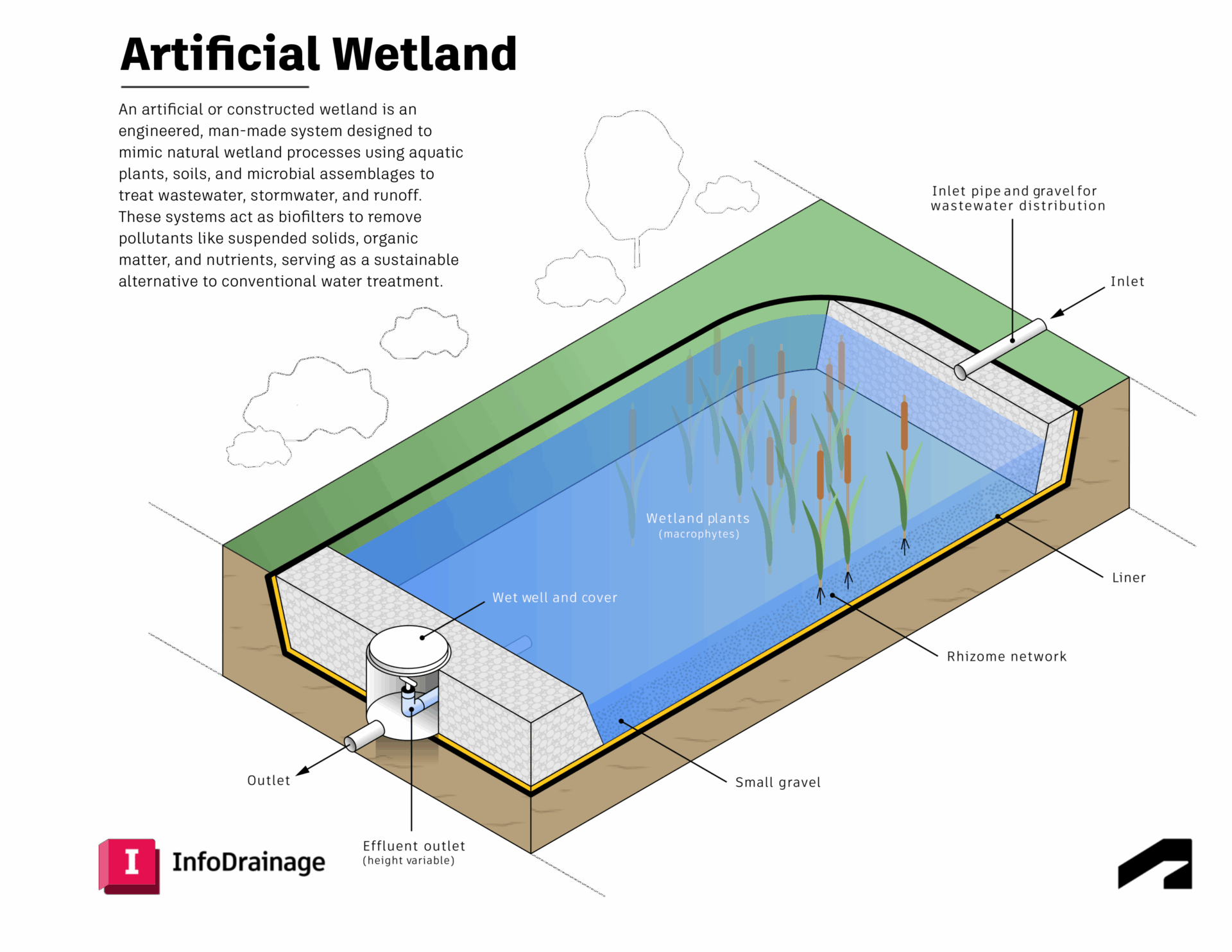
Artificial and constructed wetlands: sustainable drainage superstars
Artificial wetlands are a common feature of Sustainable Drainage Systems (SuDS) and are widely used in urban drainage design to manage stormwater and rainwater runoff, as well as promote sustainable drainage practices. An artificial wetland is a constructed ecosystem designed to manage water and pollution through engineered processes that are designed to mimic natural processes…
Sustainability
-
‘Transforming Drainage Design with AECOM’ using InfoDrainage + Civil 3D
As climate volatility and urban growth intensify, drainage systems are becoming a frontline resilience challenge. Across the UK and globally, heavier storms and expanding impermeable surfaces are overwhelming legacy sewer networks and increasing flood risk. These are a few reasons why regulation has been shifting toward more sustainable outcomes – and that’s why SuDS (Sustainable…
Drainage design
-
Best practice in sustainable drainage design: what’s holding SuDS approaches back — and what to do about it
As urban areas densify and climate-driven flood risk increases, Sustainable Drainage Systems (SuDS) have shifted from “nice to have” to essential — and in many places, effectively planning-required. Yet many organisations still struggle to deliver SuDS consistently due to fragmented processes, inconsistent requirements, skills shortages, and slow approvals. In our latest webinar, which was hosted…
Sustainability
-
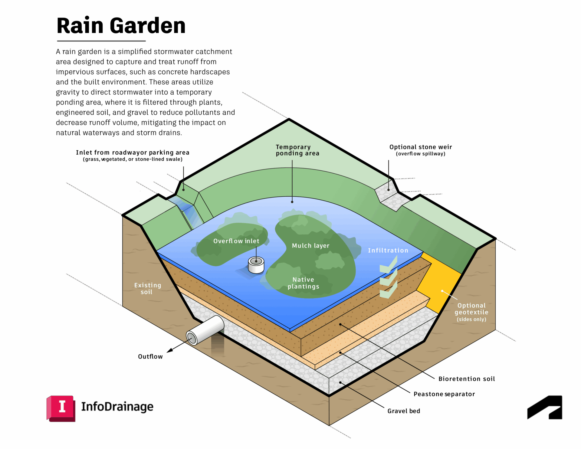
How professionals design rain gardens to effectively control stormwater runoff
Rain gardens are a common feature of Sustainable Drainage Systems (SuDS) and are widely used in urban drainage design to manage stormwater and rainwater runoff, as well as promote sustainable drainage practices. In the urban environment, hard or impervious surfaces often block the natural process of infiltration, which means rainwater can’t soak into the ground.…
Drainage design
-
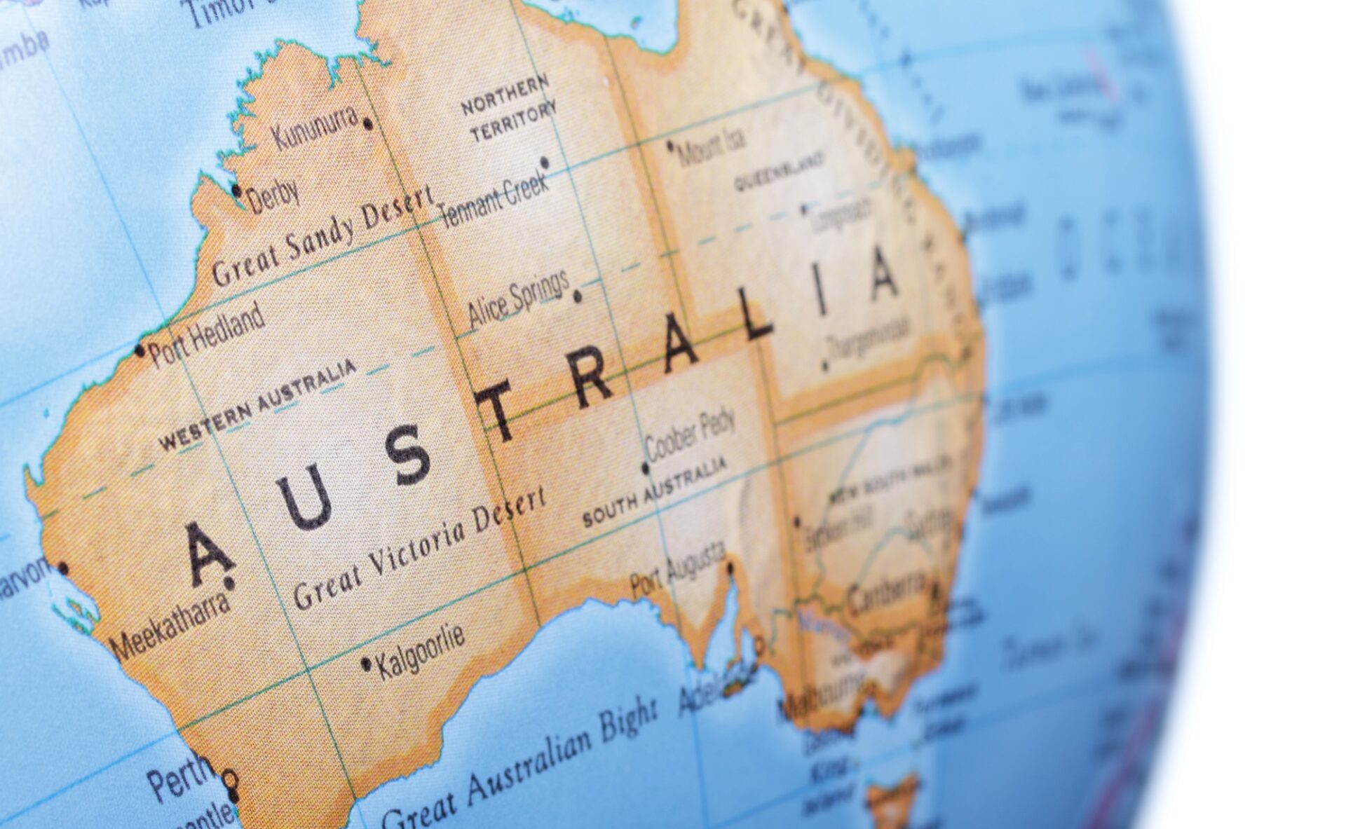
Implementing the updated Australian Rainfall and Runoff guidelines to account for climate change
With heavy short-term rainfall events becoming more intense, it’s critical that Australia’s flood maps are dynamically altered to include the most up-to-date ARR guidelines. Because our software offers customizable rainfall calculations, you can adjust equations to go beyond standard calculations – to account for climate change or to apply specific details that affect your location. Australia is…
Storm, sewer, flood