-
Hydraulic modeling explained: a guide to 1D, 2D and integrated catchment modeling
Hydraulic modelling is the simulation of how water flows through systems such as pipes, rivers, and surface floodplains. Engineers use it to predict water levels, flow rates, and flood risk, helping design and manage water infrastructure under different conditions. Hydraulic modeling often combines 1D and 2D approaches to represent both network flows and surface behavior…
Hydraulic modeling
-
InfoDrainage vs Civil 3D drainage tools: What’s different – and when to use each one
Civil 3D 2026 drainage tools are best for analyzing the drainage system in your drawing (pipes, catchments, ponds), while InfoDrainage is best for design automation, iteration, and flexible reporting.
Drainage design
-
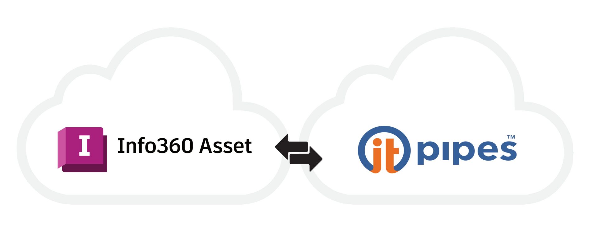
Introducing the Info360 Asset + ITpipes SmartVision integration: From CCTV inspections to confident capital plans
Utilities collect a lot of CCTV inspection data annually, but inspections by themselves do not improve results. The real challenge is translating that data into clear, defensible capital plans that stand up to regulatory scrutiny, budget constraints, and stakeholder expectations. The integration between Autodesk Info360 Asset and ITpipes SmartVision helps address that challenge by connecting…
Product news
-
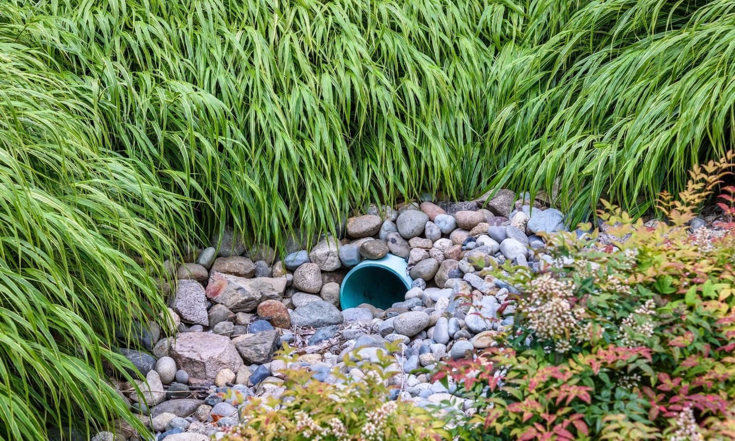
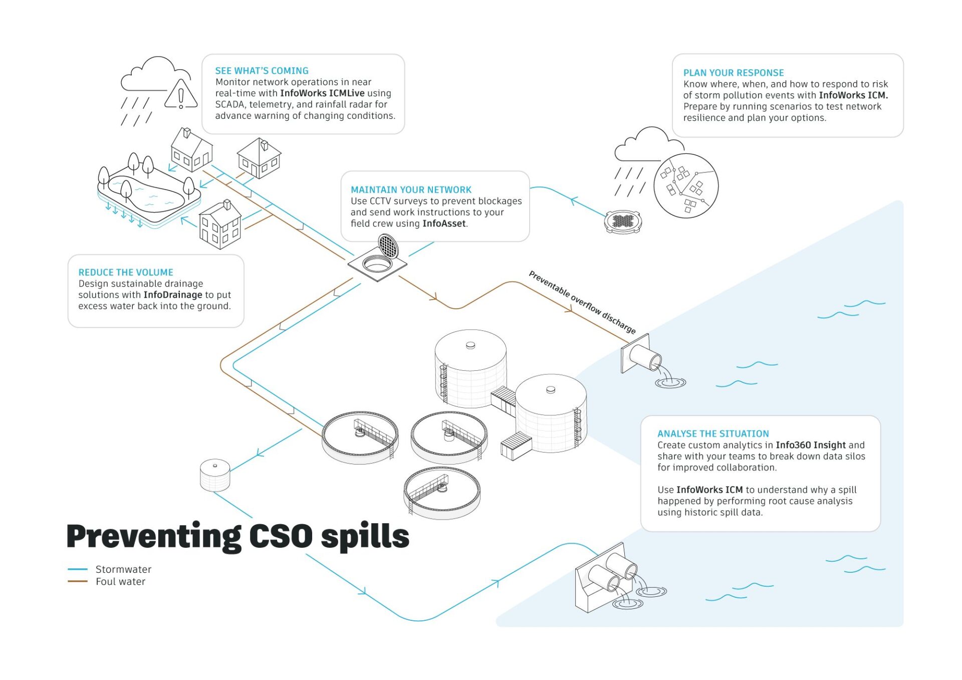
What are sustainable drainage systems (SuDS)? Features, types and design principles
In many urban areas, rainfall doesn’t soak into the ground. It runs off hard surfaces, overwhelms drainage systems, and contributes to flooding and pollution. SuDS (Sustainable Drainage Systems) are designed to change that. SuDS are designed to manage rainfall in a way that mimics natural processes – slowing, storing, and treating water close to where it…
Drainage design
-
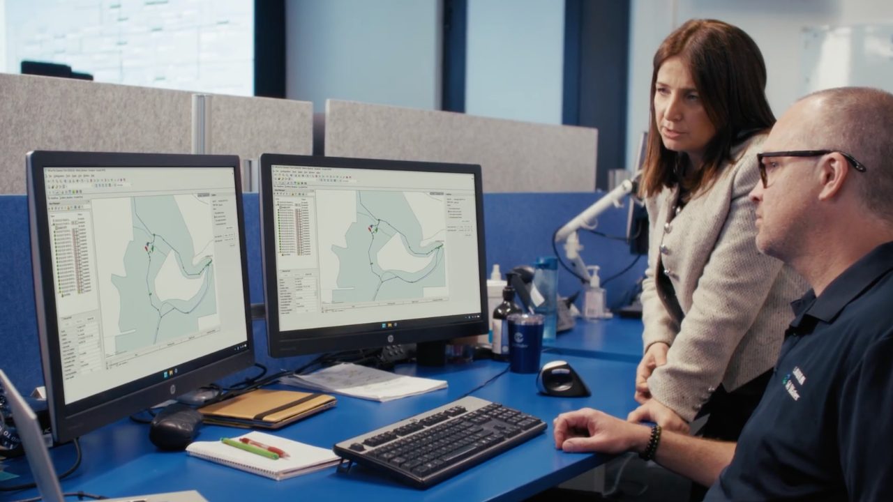
SA Water is advancing their digital maturity with live water network modelling
By implementing real-time water network modeling, SA Water is strengthening operational resilience, improving decision-making, and supporting reliable services. Water utilities today face increasing complexity: growing demand, climate variability, expanding infrastructure, and rising expectations for reliability. For SA Water, which delivers essential water and wastewater services to more than 1.8 million South Australians, managing that complexity…
Customer stories
-

Drainage designed for nature – and people: GBM’s commitment to SuDS at Fuenlabrada Fairground Park
Urban drainage is undergoing a fundamental transformation around the world. As cities expand and climate patterns become more extreme, traditional drainage strategies, which are focused almost exclusively on collecting and evacuating stormwater, are proving increasingly inadequate. Capacity constraints, water quality impacts, energy consumption, and flood risk are forcing engineers and planners to rethink how urban…
Drainage design
-

From data to impact: Highlights from the AU 2025 Water Summit roundtables
At Autodesk University 2025 Water Summit, water industry experts gathered around eight collaborative roundtables to discuss one defining question: How do we turn data into impact? The AU 2025 Water Summit brought together utilities, engineering firms, and technology providers for eight collaborative roundtables focused on advancing intelligent water infrastructure. The conversations were candid, practical, and…
Industry news
-
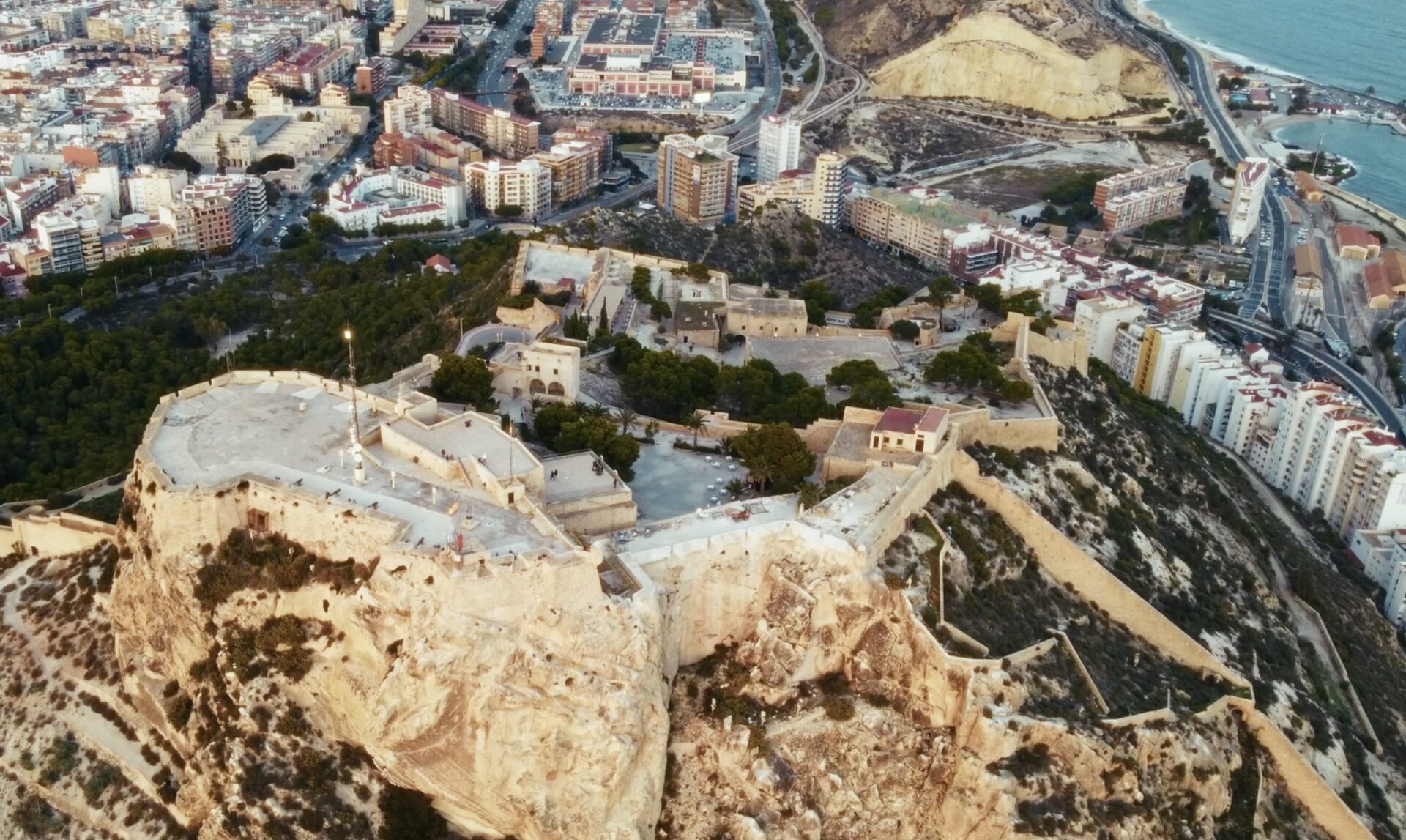
Aguas de Alicante’s digital twin water transformation
Aguas de Alicante is one of Spain’s oldest water utilities, with roots dating back to 1898 when potable water was first brought to the city of Alicante. It operates under a public-private model and manages the integrated water cycle — including water capture, treatment, distribution, sewerage, and wastewater purification — for Alicante and surrounding municipalities.…
Customer stories
-

OC San: Using data-driven asset management to improve wastewater system resilience
Serving millions of residents across Orange County is no small task. For Orange County Sanitation District (OC San), it means operating and maintaining a vast, complex wastewater system while balancing aging infrastructure and budget constraints – they have a big responsibility to use public funds wisely. “OC San’s mission in serving 2.6 million residents is…
Asset management
-
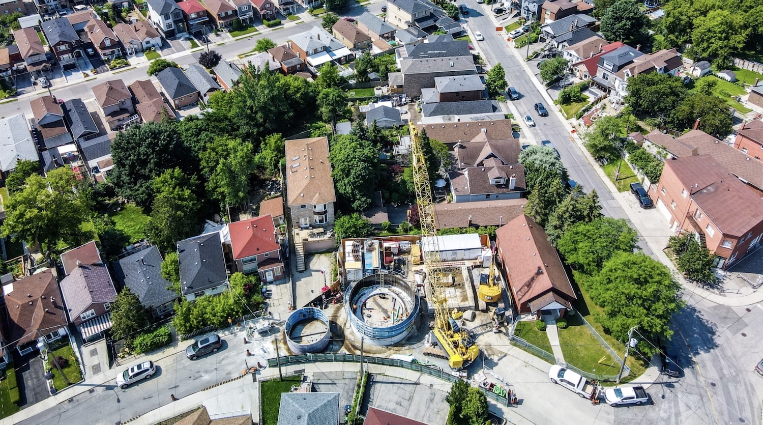
Jacobs: How 1D + 2D modeling in InfoWorks ICM is controlling stormwater in Toronto (and saving $$$)
The Woodborough Park neighborhood in Toronto is part of the Fairbank-Silverthorn area, which experiences significant flooding challenges, especially during heavy rainfall events. Their two big problems are a long history of basement flooding and sewer system overloads. Like many North American cities without separate sewer and water systems, they struggle with CSOs (Combined Sewer Overflows),…
Hydraulic modeling