The Esri User Conference returns to the San Diego Convention Center this July 13–17, bringing together thousands of GIS professionals, infrastructure leaders, technology experts, and innovators. It’s the world’s largest GIS event, focused on the latest advances in ArcGIS and the role of location intelligence in helping organizations solve problems, make decisions, and shape the future.
You have our full attention
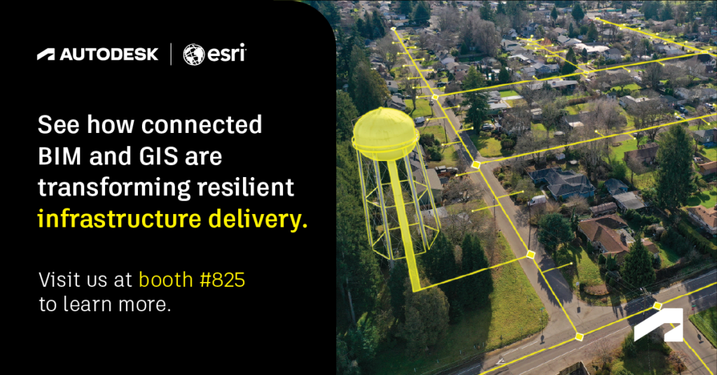
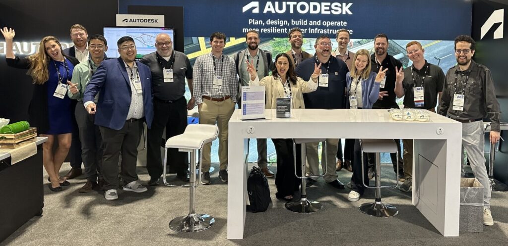
At Autodesk booth #825, our experts will showcase how connected BIM and GIS workflows can help infrastructure owners, operators, engineers, and public agencies create more resilient, data-rich infrastructure systems across planning, design, delivery, and operations.
We’d love to meet with you – and we want to be available for your full attention to discuss relevant workflows and answers your questions. That’s why we’ve put together a simple form you can fill out to schedule a time slot at our booth. Our team will match you with the right Autodesk expert based on your area of interest and industry.
Whether you’re exploring digital transformation, modernizing water infrastructure, improving transportation delivery, connecting GIS and design teams, or building a living digital twin strategy – let’s chat!
Why BIM and GIS integration matters for water and infrastructure teams
Water utilities and transportation infrastructure owners are under growing pressure to modernize aging assets, plan for resilience, manage climate-related risk, and make better decisions with trusted data. But too often, planning, design, modeling, asset management, and operations data remain disconnected across teams and systems.
That’s where connected BIM and GIS workflows can make a difference.
By bringing together Autodesk and Esri technologies, teams can connect location intelligence with engineering, design, hydraulic modeling, and asset data. The result is a more complete view of infrastructure systems, one that is founded in granular data and can evolve over time and support better decisions from early planning through long-term operations.
At Esri UC 2026, Autodesk will highlight how organizations can use connected workflows to:
- Improve collaboration between GIS, engineering, planning, and operations teams
- Bring authoritative GIS data into design and modeling workflows
- Connect infrastructure planning and design with real-world context
- Understand the full picture of your site earlier with AI-powered analyses
- Support more resilient water, transportation, and built environment systems
- Advance toward living digital twins that reflect changing infrastructure conditions over time
Visit or schedule time at Autodesk booth #825
The Autodesk booth will feature demos, customer stories, expert conversations, and presentations focused on connected Autodesk and Esri workflows. A few things we are eager to talk about:
- Water modeling and design: See how Autodesk Water Infrastructure solutions, including InfoWater Pro and InfoWorks applications, can connect GIS-centric workflows and layers with hydraulic modeling in water and stormwater to help utilities improve decision accuracy, streamline data exchange, and support more resilient networks.
- Water asset management and infrastructure planning: Discover how connected data across water and wastewater assets and GIS can help asset managers, capital planners and operational teams improve visibility into assets and support more informed capital investments and rehabilitation decisions through the power of GIS and Autodesk Info360 Asset.
- Transportation planning and design: Learn how transportation teams can bring GIS context into planning and design workflows to better understand existing conditions, coordinate across stakeholders, and improve asset delivery.
- Autodesk Forma and connected project workflows: See how Autodesk Forma helps infrastructure teams move from early planning to smarter, more connected decisions, bringing site context into design, connecting BIM and GIS workflows, and enabling the ecosystem to accelerate project delivery and build toward a living digital twin.
- Autodesk Forma Site Design: See how Autodesk Forma Site Design helps infrastructure teams move from early site analysis to conceptual site layout, collaboration, and downstream design in one connected product demo.
Customer stories: BIM and GIS in action
At Esri UC 2026, Autodesk will highlight customer examples showing how connected BIM and GIS workflows support more resilient infrastructure across water and transportation planning:
- OC San demonstrating data-driven asset management for wastewater system resilience
- Arcadis using ArcGIS for Autodesk Forma to bring real-world context into early-stage planning and design
- Cross River Rail showing how BIM and GIS can support complex transportation infrastructure delivery
Join Autodesk theater sessions at the booth
Throughout the week, Autodesk will host short theater presentations in our booth featuring Autodesk and Esri workflows, including ArcGIS for Forma, Water Infrastructure Solutions, reality capture, connectors, and partner-led sessions.
These sessions are designed to give attendees practical insight into how connected BIM and GIS workflows are being used across infrastructure planning, design, delivery, and operation and maintenance.
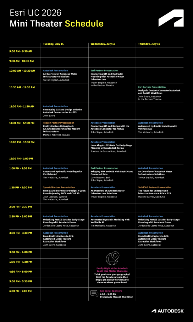
Don’t miss Autodesk partner presentations
Autodesk will also participate in Esri UC partner presentation programming, with two planned live partner presentations on water and transportation during the convention:
- Wednesday, 10:15–10:45 am: Connecting GIS and hydraulic modeling with Autodesk Water Infrastructure
- Thursday, 10:30–11:00 am: Design in context: connected Autodesk and ArcGIS workflows
See connected infrastructure workflows in action
Esri UC is a valuable opportunity to see how GIS, design, modeling, and infrastructure data come together to support better outcomes. This year’s Esri agenda includes plenary sessions, technical sessions, presentations, networking opportunities, and the Expo Hall experience across the week.
For Autodesk, Esri UC is also an opportunity to connect with customers, partners, and industry leaders who are shaping the future of resilient infrastructure. We look forward to sharing how our continued collaboration with Esri is helping teams connect data, improve decision-making, and build more resilient communities.