
Autodesk Civil 3D 2027 expands how teams design, analyze, and collaborate with the new Autodesk Assistant Tech Preview and Forma Data Management Essentials. These updates bring Autodesk AI-powered guidance and cloud-connected workflows directly into the Civil 3D experience, helping teams stay informed and aligned throughout project lifecycles. This release also includes enhancements to drainage design…
What’s New

Autodesk Civil 3D 2026.2 introduces significant enhancements to civil infrastructure workflows. These include improved drainage design and analysis tools, updates to Dynamo and Feature Lines, and the ability to export AutoCAD 3D Objects from Project Explorer. This comes in addition to new collaboration tools in Autodesk Construction Cloud (ACC) designed for Civil 3D users. Let’s…
What’s New
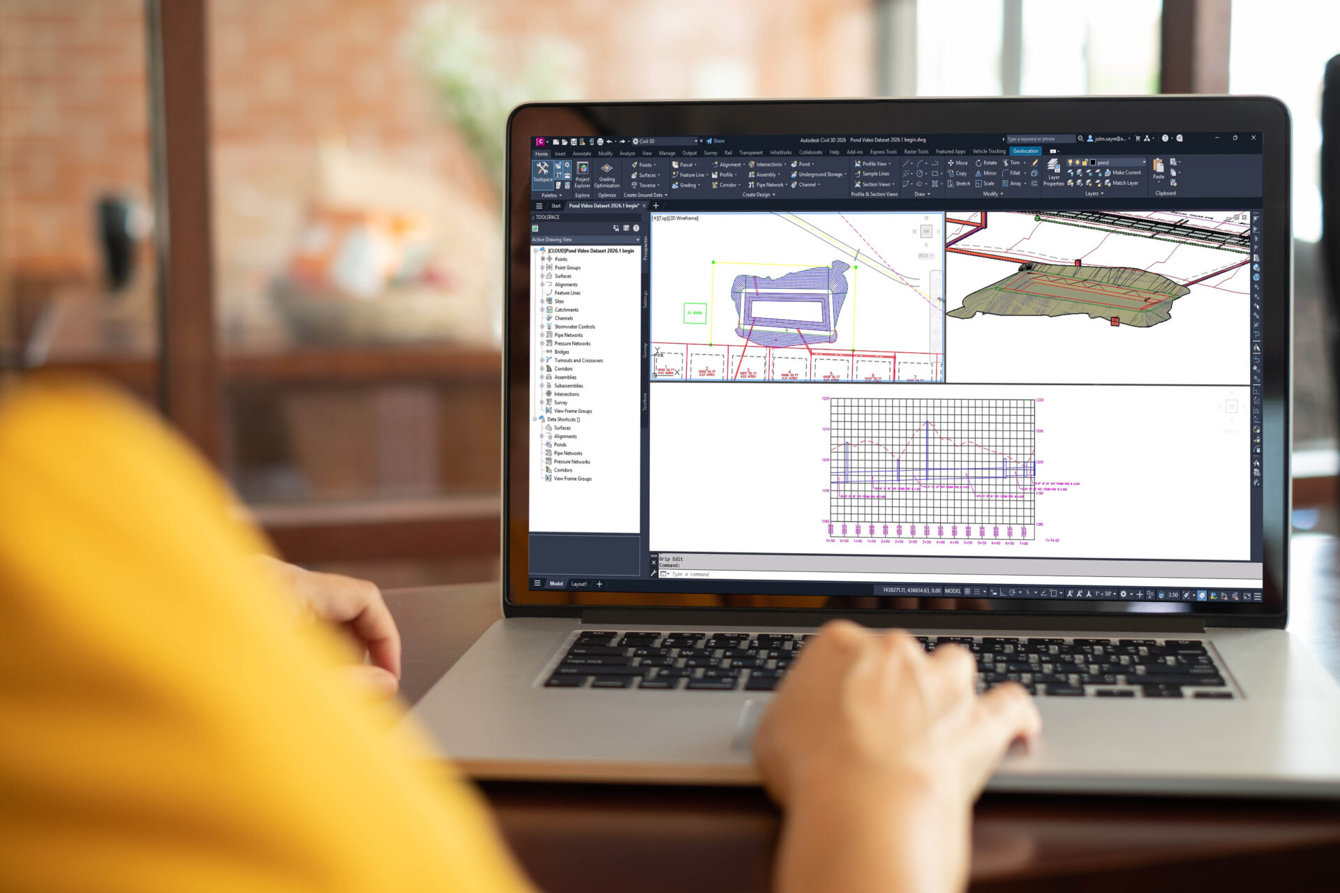
Boosting productivity and accuracy in infrastructure design is always a key focus. Civil 3D 2026.1 delivers new capabilities to help achieve just that and boasts several customer-requested improvements. From new drainage and analysis features to expansion of the popular Model Viewer, discover these latest enhancements you can start using today! Drainage Design and Analysis After…
What’s New

Contributing guest author: Michael Davidson, Esri Autodesk and Esri’s GIS integration tools bring together design information and location intelligence. By combining BIM/CAD and GIS data, designers can better understand where and how an asset fits within the built and natural environment. The result is a powerful, information-rich model that helps improve design and construction workflows…
Infrastructure

Civil engineering projects rely on effective collaboration within large complex files. The new Markup Import tool that is now available in Autodesk Civil 3D supports just that. The new functionality consolidates revisions and feedback from Autodesk Docs into Civil 3D drawings, making it easier to track and incorporate changes. Here’s how Markup Import in Civil…
What’s New
Every month, an Autodesk expert gets technical and gives their personal take on workflows that can help you. In this issue of Under the Hood, John Sayre shares how the Autodesk Connector for ArcGIS enables the use of geospatial data in your civil projects. When I attended the recent Esri User Conference in San Diego, I mixed and mingled with GIS professionals. They explained how they use GIS…
Learning