Infrastructure
-

InfraWorks and Civil 3D 2021.1 are here
Introducing Project Explorer, enhancements to bridge design, better BIM project data management, and more We at Autodesk recognize that the coronavirus (COVID-19) continues to affect communities, families, and people around…
Infrastructure
-
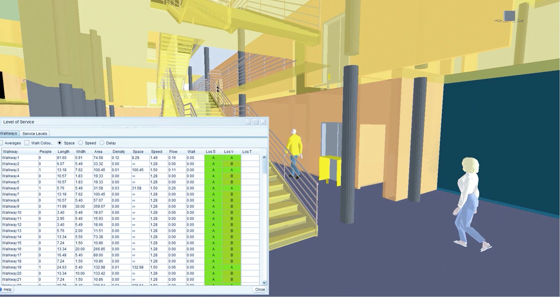
Using InfraWorks to rethink how people move through shared spaces
Use Mobility Simulation for InfraWorks® to conduct pedestrian mobility simulations that factor in global design challenges presented by COVID-19.
Infrastructure
-

The Future of Connected Bridge Design Starts Now
The global population is growing and urbanizing — by 2050, there will be around 10 billion people on the planet, according to the United Nations, and 70 percent of those…
Infrastructure
-
BIM & GIS Integration: Smarter Designs, Better Outcomes
A version of this article was published in the Geospatial Engineering publication of Civil Engineering Surveyor. The ongoing shift from more traditional computer-aided drafting & design (CAD) to building information…
Infrastructure
-

Enhanced GIS Integration and more – Get to know InfraWorks (2020.1)
Autodesk first introduced the integration of BIM and Esri’s GIS data through InfraWorks, enabling the opportunity of better infrastructure design by establishing a richer, real-world context model of the project.…
Infrastructure
-
What’s New in Civil 3D 2020.1? BIM & GIS Integration!
Our partnership with Esri continues to develop, enabling more streamlined flow of data between design tools and GIS. Now, the integration of BIM and GIS has come to Civil 3D!…
Infrastructure