The Woodborough Park neighborhood in Toronto is part of the Fairbank-Silverthorn area, which experiences significant flooding challenges, especially during heavy rainfall events. Their two big problems are a long history of basement flooding and sewer system overloads.
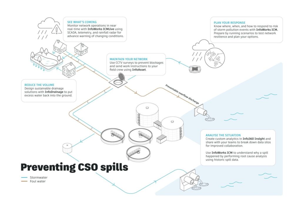
Like many North American cities without separate sewer and water systems, they struggle with CSOs (Combined Sewer Overflows), which unfortunately sometimes results in untreated mixtures of stormwater and sewage being diverted directly into local waterways, including the pride of Toronto, Lake Ontario.
But they’ve been making great progress on these challenges thanks to some smart infrastructure choices and a reliance on deeper 1D/2D combined hydraulic models to help them understand the complex interplay between underground and overland water flows.
As part of the Fairbank-Silverthorn Storm Trunk Sewer System project, Jacobs supported the City of Toronto with design and construction services for a large-scale combined sewer separation strategy. The goal was ambitious: reduce flooding risk across an entire neighborhood while improving resilience and livability at the local scale.
“The collection system there is really just not suited anymore to deal with the volume of stormwater,” explains Eric Kohnen, Water Resources Engineer at Jacobs. “The whole park, all the facilities in particular, were kind of getting impacted every time there was significant rain.”
Capturing real-world problems with integrated modeling
To tackle the challenge, Jacobs needed confidence that their analysis reflected what was actually happening on the ground – and underground. Traditional approaches alone wouldn’t be enough.
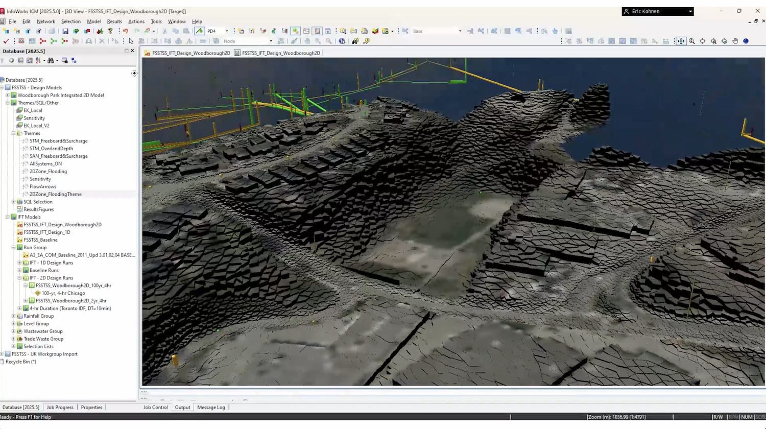
Using Autodesk’s InfoWorks ICM, the team combined 1D network modeling with detailed 2D surface modeling to capture the full picture of flooding behavior across Woodborough Park. This type of approach is often referred to as integrated catchment modelling, where surface flow, drainage networks, and river systems are analyzed together rather than in isolation. This integrated approach allowed them to understand not only how the sewer system performed, but also how water flowed across the park itself.
“Because ICM is so flexible in terms of merging 2D and 1D models, that was a huge benefit for us because we were working on a larger 1D design model for the rest of the project, so that really avoided complicating the workflow,” says Kohnen.
The ability to move seamlessly between system-wide analysis and site-specific detail helped the team test, refine, and optimize design options more efficiently.
Visual appeal: Clear communication, better decisions
Beyond technical performance, visualization played a key role in collaboration with stakeholders. With 2D results clearly showing flood extents, ponding depths, and design performance, project discussions became more concrete and productive.
“Having a dedicated viewer for whoever you’re working with, especially clients – being able to log in and directly look at model results and having a 2D model to show results – also is just a further benefit because of how clear it is to see where flooding is happening, how deep your ponding is, and how well your designs are performing,” says Kohnen.
Having the benefit of working with 1D + 2D models helped them locate the best position for a catch basin and determine the exact level of water to maintain on the surface to prevent flooding in the park.
This clarity and visualization power also made it easier to explain trade-offs, review alternatives, and align on decisions throughout the design process.
Optimizing design and reducing cost
The detailed surface modeling also revealed opportunities to refine the design in ways that wouldn’t have been apparent with a 1D-only approach. By better understanding flow paths, surface roughness, and real-world obstacles, the team identified where conservatism could be reduced without compromising performance.
“Taking a 2D approach showed us some of the conservatism that’s baked into using a 1D model,” says Kohnen. “You’re not capturing things like winding flow paths and obstacles, changes in surface roughness—like real world conditions.”
Armed with this insight, Jacobs was able to significantly optimize the underground storage design.
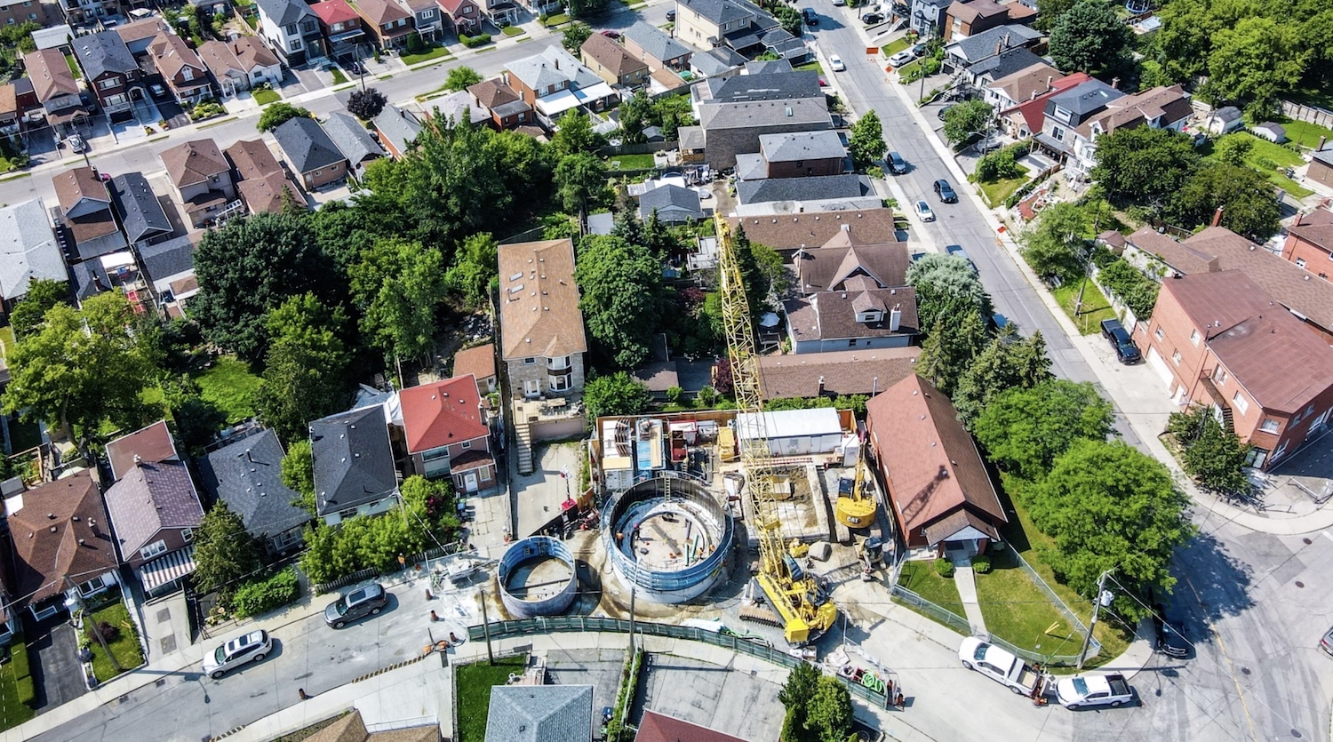
“The model was a great tool for helping us optimize the location of the storage facility, especially with the underground portion. We reduced the underground portion of the storage by 35%,” Kohnen explains. “That was a measurable benefit just in terms of constructibility.”
The impact of that one change was substantial: the team estimated savings of approximately CAD $2.5 million, while still meeting flood mitigation goals for the park and surrounding neighborhood.
Supporting a long-term stormwater strategy as Autodesk power users
Woodborough Park is just one piece of Toronto’s broader basement flooding program, which has been underway for more than two decades and will continue well into the future. For Jacobs, scalable and versatile tools are essential to supporting that long-term vision.
With more than 120 everyday users of InfoWorks ICM and hundreds of licenses across the consultancy, Jacobs is a power user of Autodesk Water Infrastructure solutions, using our software to deliver resilient, cost-effective outcomes for communities.
“ICM as a whole is just a very versatile tool at working at a variety of scales,” says Kohnen. “Whether you’re looking at watersheds, collection systems, site-specific studies… the future is going to be really bright for ICM.”
As cities face growing climate and infrastructure challenges, projects like Woodborough Park demonstrate how integrated modeling can support smarter decisions – and help communities move closer to a more resilient future, drop-by-drop.
When you need both 1D and 2D
We are big fans of integrated 1D + 2D modeling approaches, which can be extremely accurate and comprehensive using InfoWorks ICM:
- Do you use HEC-RAS? Learn about 1D and 2D modeling with HEC-RAS & InfoWorks ICM: Differences, similarities, and an integrated workflow
- Do you want to use both 1D and 2D? Read our quick guide to 1D vs 2D hydraulic modeling: What’s the difference? Pros and cons? How do you decide?
- Want to use the InfoWorks ICM Viewer? It’s free. Grab a copy here.