
说明
This presentation will explore using a combination of LiDAR (light detection and ranging)-derived existing models and proposed Building Information Modeling (BIM) modeling. Topics to be covered include an introduction to 3D laser scanning, using ReCap software to exploit LiDAR data to obtain as-built or existing conditions, bringing the point clouds into InfraWorks software and 3ds Max software for preliminary and conceptual design, generation of BIM design for AutoCAD Civil 3D software, and blending LiDAR data with proposed design in AutoCAD Civil 3D software. We will demonstrate how to avoid potential construction issues by combining these technologies to virtually construct the project. We will also discuss integrating industry innovations, including unmanned aerial vehicles (UAV) and automatic machine grading (AMG).
主要学习内容
- Learn how to handle LiDAR data in ReCap and prepare for design use
- Learn how to use LiDAR and other models in InfraWorks
- Learn how to use LiDAR and other models in 3dS Max
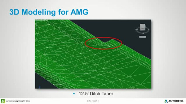
- Learn how to bring LiDAR into AutoCAD Civil 3D and use it to create and design
Downloads
标记
产品 | |
行业 | |
主题 |
喜欢这门课的人也喜欢
Instructional Demo