Point Layout: Reduce construction site errors
Validate and verify layout with BIM and CAD data

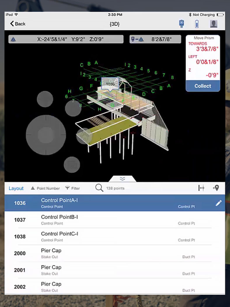
What is Point Layout?
Autodesk Point Layout brings BIM coordinate systems to the jobsite. Connect building models to field construction workflows, with hardware compatibility including Leica, Topcon, Trimble, and more.
Lay out projects with greater accuracy and avoid errors
Rely less on time-intensive manual measurements
Work with AutoCAD, Revit, and Navisworks files and push site data to the Autodesk Construction Cloud

Save time with automatic point creation

Export, import, and compare model data
Verified construction against design intent
Save time with automatic point creation
Export, import, and compare model data
Verified construction against design intent
Questions? We have answers.
Autodesk Point Layout is used to bring precision and accuracy to construction layout and verification workflows leveraging BIM and CAD data. By using Point Layout, contractors can better pinpoint project coordinates and layout measurements, capture as-built conditions, and move data between the field and office to save time, reduce errors, and improve communication.
Contractors, subcontractors, BIM managers, and VDC teams use Point Layout to drive accurate layout and verify construction against design intent.
Your Point Layout subscription gives you access to install and use the 3 previous versions. Available downloads are listed in your Autodesk Account after subscribing. See also previous releases available for subscribers.
Products you can trust
From payment flexibility to always-on support, expect excellence.


